
USGS Volcanoes🌋
@USGSVolcanoes • 167,148 subscribers
Delivering official updates and info for U.S. volcanoes. https://t.co/eugs1G0ISb email: [email protected]
Shorts


Videos

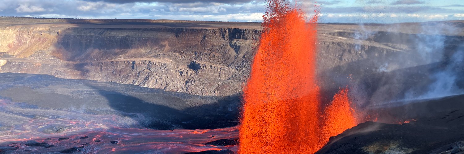
Here are some other views of Kīlauea summit eruption lava fountaining episode 38 in Halema‘uma‘u crater on the Island of Hawai‘i, and answers to some of your questions about this activity. This eruptive episode began from the north vent at about 8:45 am HST this morning, December 6. Smaller fountains began from the south vent at 8:49 am HST and quickly grew to over 1000 feet (300 meters) high and inclined to the south, towards a closed area of Hawaiʻi Volcanoes National Park. At 9:55 a.m., hot tephra falling from this fountain destroyed the V3 streaming camera site located within less than a mile (2,000 ft/500 m) from the eruptive vents; its burial highlights the hazardous nature of this closed area. The north vent stopped erupting at 11:50 a.m., but the south vent is still fountaining as of this posting. In addition to the tephra, volcanic gas is being emitted, with sulfur dioxide emission rates likely exceeding 50,000 tonnes per day. The high effusion rate of this episode is also producing a very dramatic plume extending over 20,000 feet above sea level. Both the National Weather Service and Washington Volcanic Ash Advisory Center issued special advisories about this plume, and the Hawaii County Civil Defense Agency issued a message about the potential for fine glass particles in communities downwind. Kīlauea's recent eruptive episodes have gone on for 5-9 hours; this episode has been active for about 4.5 hours now. The USGS Hawaiian Volcano Observatory staff are closely monitoring this activity, coordinating with partners at Hawaiʻi Volcanoes National Park and the Hawaii County Civil Defense Agency. #Kilauea #lava #eruption
USGS Volcanoes🌋217,986 次观看 • 9 个月前

In case you ever wondered what it would be liked to be engulfed in a lava fountain... This video was recorded by the V3 camera, located on the south rim of Halema‘uma‘u crater at the summit of Kīlauea volcano on the Island of Hawai‘i. The camera, located in a hazardous closed area of Hawai‘I Volcanoes National Park, was buried by tephra from an inclined lava fountain between 9:55 and 9:57 am HST on December 6, during episode 38 that began this morning at 8:45 am. RIP V3 🪦 V1 ( and V2 ( continue to operate.
USGS Volcanoes🌋185,165 次观看 • 9 个月前

Episode 54 of the Kīlauea summit eruption happened yesterday, August 25, on the 110th birthday of the National Park Service! ⏰ Lava fountained only from the north vent for 9 hours, from 10:30 a.m. to 7:33 p.m. HST. 📏 The north vent lava fountain reached a maximum height of about 500 feet (150 meters), similar to several of the past recent episodes. 💨 Winds were out of the northeast causing the plume, which reached about 17,000 feet (5,200 meters) above sea level, to move to the southwest with most tephra falling in the closed area of Hawaiʻi Volcanoes National Park. 💥 An estimated 5.2 million cubic yards (4.0 million cubic meters) of lava erupted in total, covering about 30% of Halemaʻumaʻu crater floor. ⛔️ Kīlauea alert level/aviation color code was at WATCH/ORANGE throughout the episode and lowered to ADVISORY/YELLOW when the episode ended. Inflation has resumed following the end of the episode, so another fountaining episode is likely in the coming weeks. 📹 Video clips show Kīlauea episode 54 lava fountaining on August 25, 2026. #Kilauea #Lava #Eruption
USGS Volcanoes🌋11,593 次观看 • 13 天前


In the early morning hours of June 13, 2026, a small hydrothermal explosion occurred at Biscuit Basin in Yellowstone National Park! The activity was recorded by a camera and other monitoring equipment and resulted in major changes to the landscape. Today’s Caldera Chronicles blows open the story! ▶️Explosion took place at 5:09 a.m. MDT on June 13, 2026 ▶️The event was captured by a remote camera, as well as seismic and infrasound monitoring instruments installed nearby ▶️The location was the barren area just north of Black Diamond Pool (that pool was the site of a larger hydrothermal explosion on July 23, 2024) ▶️Three new vent areas opened, including an 18.5-meter (61-foot) fissure filled with boiling water ▶️Rocks were thrown a few meters (yards), indicating the explosive energy was much lower than that of the 2024 event ▶️High levels of water discharge from the vents entrained sediment and drained into the Firehole River, creating milky streaks in the river that persisted far downstream ▶️About 2 or 3 days later, a circular collapse featured formed in the area of the explosion and filled with near-boiling water ▶️On June 18, geyser-like spouting about 6-9 meters (20-30 feet) high was observed from the new circular pool ▶️Yellowstone Volcano Observatory scientists deployed new monitoring equipment in the basin last week to track the evolving nature of the activity Biscuit Basin remains closed to visitors. 📽️: Video showcasing the June 13, 2026, hydrothermal explosion at Biscuit Basin and its consequences. Yellowstone National Park
USGS Volcanoes🌋34,127 次观看 • 2 个月前

Time for an aerial tour of Mount St. Helens! Summer has arrived, and that means field work in the Cascades. On Wednesday, June 24, teams from the Cascades Volcano Observatory were at Mount St. Helens to swap batteries, upgrade GPS sites, solidify solar power systems, remove legacy equipment, and survey river channels for changes. Along the way, one of the field crews captured this aerial video of the crater of Mount St. Helens. The helicopter flies up the western arm of the Crater Glacier, past the 1980-86 lava dome, and then swings to the left around the still-steaming 2004-08 lava dome to get a view to the north out of the crater at Johnston Ridge, Spirit Lake, and Mount Rainier in the distance. Cascades Volcano Observatory update for Friday, June 19, 2026: All volcanoes in the Cascade Range of Oregon and Washington were at normal background levels of activity for the last week. Small earthquakes were detected at Mount Rainier and Mount St. Helens. 📽️: USGS video from helicopter flight into Mount St. Helens Crater by Marco Bagnardi, June 24, 2026.
USGS Volcanoes🌋27,872 次观看 • 2 个月前

Join three USGS–Hawaiian Volcano Observatory scientists as they embarked on a helicopter mission to the northwestern wall of Halema‘uma‘u at Kīlauea’s summit on July 2, 2026. Their goal was to sample tephra deposits from the crater wall, which had been inaccessible before now. As lava flows have filled in Halemaʻumaʻu, the floor of the crater has risen but the deposits, records of past explosive eruptions in Kīlauea's history, could be covered by lava flows in the future. These samples were collected with permission from Hawai'i Volcanoes National Park and will help us better understand eruption behavior, magma storage, and volcanic hazards. 🛰️ This behind-the-scenes glimpse highlights the sampling mission in Halema'uma'u on July 2, 2026. #Kilauea #Tephra #Hazards
USGS Volcanoes🌋23,169 次观看 • 2 个月前


Glimpse into the eruptive vents at Kīlauea summit as we await the start of episode 50 of lava fountaining. This video was taken during a misty USGS Hawaiian Volcano Observatory monitoring overflight on June 24, with views accompanied by a rainbow (ānuenue). • Aerial views into the north and south vents show them steadily emitting volcanic gases. Magma is visible roiling within the bifurcated interior of the north vent. • With permission from Hawaiʻi Volcanoes National Park, USGS scientists briefly landed on Halemaʻumaʻu crater floor to collect warm lava samples from episode 49, which will provide data on magma chemistry and underground storage conditions. • The onset of episode 50 of lava fountaining at Kīlauea summit is likely between June 25 and June 27, with June 26 most likely. Continuous strong glow was visible on webcams from both vents in Halemaʻumaʻu overnight. The south vent continued to produced large flames caused by the burning of gas within the top of the conduit. Magma is close to the surface, visible within the north vent during the overflight on June 24. 🎥: Videos of Kīlauea summit taken during helicopter overflight on June 24, 2026. #Kilauea #HVO #Rainbow
USGS Volcanoes🌋23,703 次观看 • 2 个月前

And another one! On Wednesday, April 29, at about 12:28 PM MDT, there was another eruption at Black Diamond Pool (in Biscuit Basin, Yellowstone National Park)! This one was larger than Tuesday's event and sent muddy water and steam towards the camera, which sits on a remnant of the boardwalk that was wrecked by the July 23, 2024, explosion from the pool. This is perhaps the largest eruption of the pool since the 2024 explosion and is an important demonstration of hydrothermal hazards in Yellowstone National Park! 📹: This eruption at Black Diamond Pool occurred on Wednesday, April 29, just before 12:28 AM MDT. It is probably the largest such event to have occurred at the pool since the explosion of July 23, 2024.
USGS Volcanoes🌋28,784 次观看 • 4 个月前

#MountStHelens May 18, 1980, 8:32 AM. A colossal landslide. Magma & hot fluids explode, surge outward like a hot hurricane. Column rises, ash falls for miles. Snowpack melts, mudflows converge, lahars move downvalley. A 9-hr eruption. Everything is changed. #VolcanoAwarenessMonth
USGS Volcanoes🌋116,531 次观看 • 2 年前

Episode 37 of the ongoing Halemaʻumaʻu eruption began at 2:30 p.m. HST on November 25 and is ongoing. Sustained lava fountains at the summit of Kīlauea are about approximately 400 feet (120 meters) in height. Winds are light from the north-northeast and will take most tephra and gas to the south-southwest. Watch along on the USGS livestream cameras:
USGS Volcanoes🌋49,968 次观看 • 9 个月前

🌋Kīlauea eruption episode 48 summary - a historic new record for Kīlauea! Episode 48 of the Kīlauea summit eruption in Hawai‘i Volcanoes National Park stopped at 1:37 pm HST June 1 after 9 hours of lava fountaining. This eruption has now surpassed the number of fountaining episodes in the opening years of the Puʻuʻōʻō eruption from 1983-1986 (47), setting a new record number of fountaining episodes in any one Kīlauea eruption. 🌋 Lava flowed from the south vent about 95 times in the days before episode 48, but only the north vent produced a lava fountain (up to 650 ft/200 m) during the episode. This pattern has been followed during the past several episodes. An estimated 7.3 million cubic yards (5.6 million cubic meters) of lava spilled across Halemaʻumaʻu. 💨 The eruptive plume rose to about 24,000 ft (7,300 m) above sea level; higher level winds from the south caused tephra to fall north and east of Kaluapele (Kīlauea caldera) at overlooks within Hawaiʻi Volcanoes National Park, as well as on Highway 11 near Nāmakanipaio Campground, Volcano village, Mauna Loa Estates, and Ohia Estates. The National Weather Service issued an ashfall advisory for these areas downwind. ⛔️ The USGS kept the Kīlauea alert level/aviation color code at WATCH/ORANGE throughout the episode because fallout was not extensive and did not last very long. After the episode ended, USGS lowered Kīlauea to ADVISORY/YELLOW reflecting that volcanic activity had decreased significantly but continues to be closely monitored for possible renewed increase. Kīlauea summit region inflation since the end of episode 48 indicates that another fountaining episode is possible; however, more time is needed to collect data to generate the model to forecast episode 49, which will set a another new record for Kīlauea. 📹 Video clips show Kīlauea episode 48 lava fountaining on June 1, 2026. #Kilauea #Lava #Eruption
USGS Volcanoes🌋21,513 次观看 • 3 个月前

Kīlauea episode 43 of lava fountaining at the summit, within Hawai’i Volcanoes National Park continues at this time. The lava fountain from the south vent has decreased to around 1000 feet (300 meters) high and the lava fountain from the north vent is 700 feet (200 meters) high. Tephra fall to the north and east has greatly reduced in the past hour. Fine ash and Pele’s hair has been reported falling as far as Hilo and Hawaiian Paradise Park. Help support science and community awareness by submitting a tephra fall report at: The National Weather Service has issued an Ashfall Warning for the region around Kīlauea summit and an Ashfall Advisory for the communities to the east. Hawaii County Civil Defense Agency announced the closure of Highway 11 between the 24 and 40 mile markers due to dangerous conditions being created by tephra falling. Hawai’i Volcanoes National Park has announced that temporary closures around Kīlauea summit are in place due to volcanic hazards. Lodging guests of Volcano House and Kilauea Military Camp will be allowed to enter the park. 🎥 Video of episode 43 fountaining and eruptive plume on March 10, 2026. Tephra clast that landed in National Park, and Pele’s hair/ash in Hilo. #Kilauea #hazards #ash
USGS Volcanoes🌋31,135 次观看 • 6 个月前

During Episode 49, at about 2:07 p.m. on June 14, a whirlwind hit the V3 live streaming camera. These whirlwinds are a variety of dust devil that form in the presence of heat, which causes upward air flow, and strong windshear. The Hawaiian Volcano Observatory maintains three live streams of the eruption, which can be accessed at: V1: V2: V3: #Kilauea #Eruption #Lava
USGS Volcanoes🌋17,465 次观看 • 2 个月前

Kīlauea’s summit eruption Episode 46 ended at 5:22 pm HST on May 5 after 9 hours of lava fountaining. 🌋 Only the north vent fountained, reaching heights of 650 ft (200 m). About 6 million cubic yards of lava covered over half of Halemaʻumaʻu’s crater floor. 💨 The plume rose to 20,000 ft (6,000 m), with tephra falling N-NW and NE of the crater. Fist‑sized fragments reached areas along the north caldera rim and Highway 11. Pele’s hair was reported in Volcano Golf Course and Mountain View. ⛔️ USGS maintained WATCH/ORANGE during the episode and lowered to ADVISORY/YELLOW afterward. NWS issued an ashfall advisory for S/SE Hawai‘i Island. Kīlauea summit inflation after Episode 46 suggests another fountaining episode is possible, but more data is needed before forecasting Episode 47. 📹 Views of episode 46 on May 5, 2026. #Kilauea #Lava #Eruption
USGS Volcanoes🌋22,293 次观看 • 4 个月前
