
Jordan Hall
@JordanHallWX • 53,272 subscribers
@MyRadarWX International Storm Chaser, Multimedia Journalist @Severestudios, Team Dominator, Media inquires email: [email protected]
Shorts


Videos

DVD sized hail west of Canyon, Texas DESTROYS my windshield. NWS Amarillo Aaron Rigsby MyRadar Weather #txwx
Jordan Hall366,968 Aufrufe • vor 26 Tagen

Captured this semi flipping with Blake Brown south of Dumas, TX #txwx
Jordan Hall1,781,027 Aufrufe • vor 5 Monaten

FIRST drone images of Rota after the devastating impact of Super Typhoon Bavi. No, this isn’t Guam, this is the small island to the north. Most people don’t know this place even exists and they could really use your help. Aaron Rigsby NWS Guam 🇬🇺 #wxtwitter #typhoon #bavi #marianasislands
Jordan Hall104,747 Aufrufe • vor 11 Tagen


First Light of Rolling Fork Mississippi after a Violent #Tornado last night. #mswx SevereStudios MyRadar Weather
Jordan Hall5,191,686 Aufrufe • vor 3 Jahren

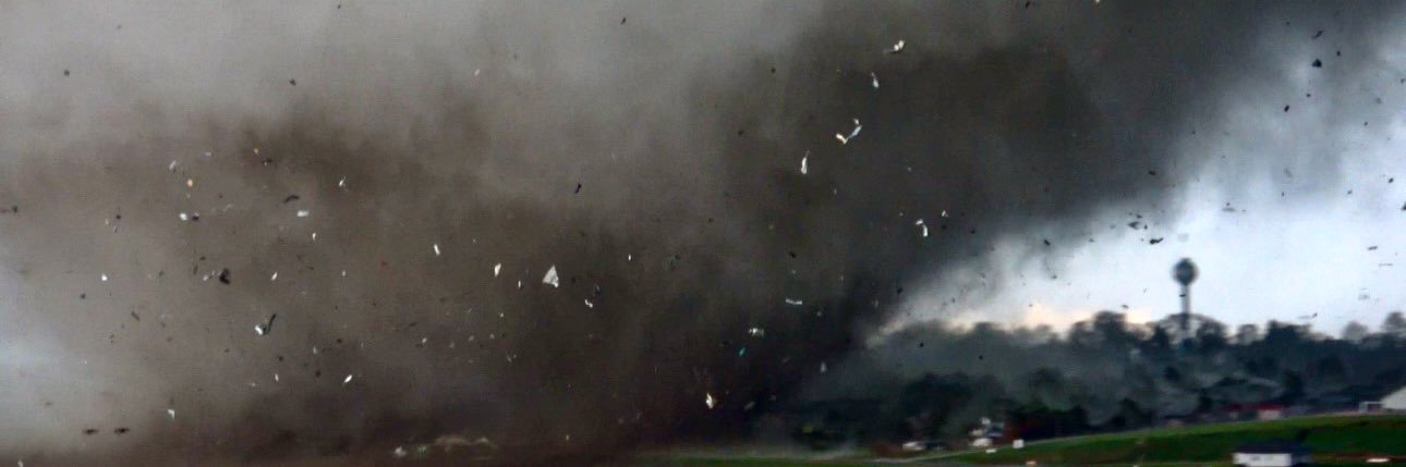
Aftermath of significant #tornado in Streator, Illinois. MyRadar Weather #ilwx
Jordan Hall159,257 Aufrufe • vor 1 Monat


Look at this EXPLOSION!! The #tornado must have hit some sort of oil or gas facility in Nashville TN
Jordan Hall3,086,584 Aufrufe • vor 2 Jahren

First Light of Barnsdall, Oklahoma after last nights deadly #tornado #okwx
Jordan Hall2,562,452 Aufrufe • vor 2 Jahren


Fully engulfed home in Tylertown, MS from a lightning strike. MyRadar Weather #mswx
Jordan Hall164,169 Aufrufe • vor 2 Monaten


Sounds like a JET ENGINE as Super Typhoon Bavi continues to howl in Saipan. #Typhoon #Bavi #Saipan
Jordan Hall30,673 Aufrufe • vor 14 Tagen

This was absolutely insane. 6 feet deep craters as well near Prescott, Iowa. #iawx DJI #wxtwitter
Jordan Hall1,307,822 Aufrufe • vor 2 Jahren