NWS Boulder's banner
NWS Boulder's profile picture

NWS Boulder

@NWSBoulder134,076 subscribers

Official Twitter account for the National Weather Service Denver/Boulder forecast office. Details: https://t.co/A4aVgbxmgI

Shorts

You know it's hot when a bear needs a bath! This video was captured this morning at our office in Boulder. #COwx

You know it's hot when a bear needs a bath! This video was captured this morning at our office in Boulder. #COwx

30,874 Aufrufe

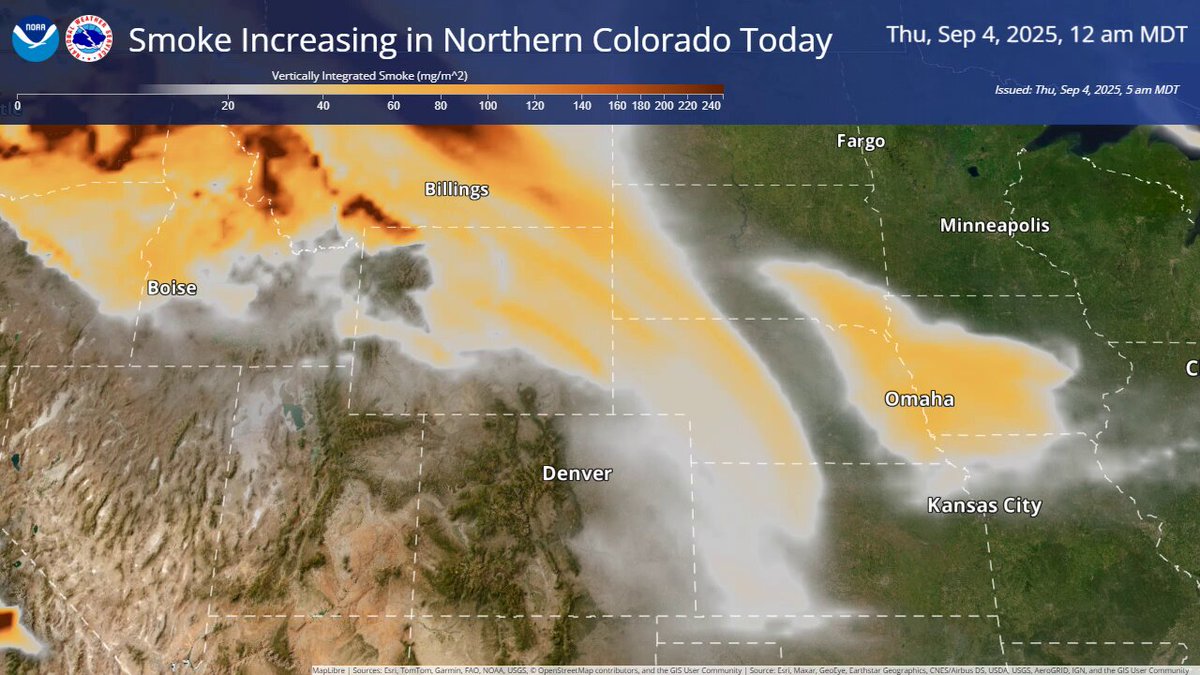
Smoke from distant fires will move into northern Colorado today. This loop shows the plume aloft. Surface smoke will be worst in northeast Colorado this afternoon and in Denver this evening, along a cold front. More info:

Smoke from distant fires will move into northern Colorado today. This loop shows the plume aloft. Surface smoke will be worst in northeast Colorado this afternoon and in Denver this evening, along a cold front. More info:

29,091 Aufrufe

Significant early season wildfire activity in Canada, particularly the provinces of British Columbia and Alberta where over 1M acres have burned, will likely bring an increase in smoke for Colorado over the coming days. (1/2) #COwx

Significant early season wildfire activity in Canada, particularly the provinces of British Columbia and Alberta where over 1M acres have burned, will likely bring an increase in smoke for Colorado over the coming days. (1/2) #COwx

58,629 Aufrufe

Strong and rapidly intensifying thunderstorm over the western Denver metro at this time. Expect hail up to 1" in diameter under the core(s), but hail size may increase with time. Stay indoors! Appreciate any hail and flooding reports as well. #COwx

Strong and rapidly intensifying thunderstorm over the western Denver metro at this time. Expect hail up to 1" in diameter under the core(s), but hail size may increase with time. Stay indoors! Appreciate any hail and flooding reports as well. #COwx

42,656 Aufrufe

⚠️ Avoid I-70 between Watkins and Strasburg! ⚠️ Severe t-storm with up to **3 inch** diameter hail and 70 mph moving ENE over the area over the next half hour. This is a destructive storm. #COwx

⚠️ Avoid I-70 between Watkins and Strasburg! ⚠️ Severe t-storm with up to **3 inch** diameter hail and 70 mph moving ENE over the area over the next half hour. This is a destructive storm. #COwx

29,513 Aufrufe

Winds to increase late tonight across the Front Range Mountains and Foothills. Gusts between 55-65 mph are expected, with localized gusts to 75 mph possible in the foothills of Boulder County. Patchy blowing snow is expected for elevations above 9,000 feet.

Winds to increase late tonight across the Front Range Mountains and Foothills. Gusts between 55-65 mph are expected, with localized gusts to 75 mph possible in the foothills of Boulder County. Patchy blowing snow is expected for elevations above 9,000 feet.

10,272 Aufrufe

Videos

Keine weiteren Inhalte verfügbar