Загрузка видео...

Не удалось загрузить видео

На главную

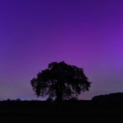
Certainly didn't expect to see so much snow falling tonight here in North Warwickshire #StormHour #ThePhotoHour #loveukweather #uksnow Met4Cast - UK Weather Shefali Oza @uksnowwatch
39,178 просмотров • 7 месяцев назад •via X (Twitter)

Комментарии: 0

Нет доступных комментариев

Здесь появятся комментарии из оригинального поста

Похожие видео

Winter Weather Advisory ⚠️ for Lake Cook Dupage and Will counties and south from there from 6PM Saturday to 6PM Sunday If it was just system #snow giving us a glancing blow from the expansive southern storm dumping every type of weather from #Chicago to the gulf coast, an easy forecast of 1”-4” north to south would be on the table But dance with the devil we must as Lake Michigan sits poised to be either a reluctant dance partner or the lead tango dancer in the snow show Forecasts range from 2”-9” in the city. 2” means no lake impact, 9” means we get a long duration lake feed I’m leaning toward the latter, as entrenched cold air, mid and low level wind convergence over the lake, a lengthy North-Northeast wind fetch and still open mid lake surface water should be enough to loft even a little moisture 2-3 miles upward to feast on an excellent snowflake growth zone that will feed into the immediate Chicago shore areas and add another 3”-5” to the system snow. Another tricky point is the ratio of liquid to snowfall. Usually we see a 10 to 1 mix. 0.1” liquid=1” snow. This cold air here will double that to 20 to 1 so even an extra 1/4 inch of liquid would be 5” of snow (0.25x20=5.0) to add in And by immediate shore areas I could see Midway getting double what O’Hare gets. Like Cicero Ave and east being a cutoff Here’s the model variance. Snow would start to trickle in about sunset Saturday and just hang out thru much of Sunday into the afternoon.

WindyCity Weather and News

55,195 просмотров • 7 месяцев назад

❄️ SNOWFALL REPORT: Week of 1/18 – 1/25 ❄️ This is a another BIG one. A HIGH IMPACT Winter Storm could develop late this upcoming week, with the potential to bring Heavy Snow and Ice to parts of the country. 🌨️ The heaviest Snow will likely fall on the north side of this storm Friday - Sunday, wherever it ultimately tracks. As we move through the week, I would not be surprised to see Winter Storm Watches and Warnings issued as it becomes more clear where this storm will setup. ❄️When it comes to exact locations and Snow totals, we are still WAY too far out to pin that down. That said, the most likely SNOW ZONE appears to be somewhere within the Tennessee and Ohio Valleys, though this will almost certainly shift as we get closer. ❄️Elsewhere, the Midwest will see a few rounds of light to moderate Snow Monday through Wednesday as a series of Alberta Clippers pass through. These should be minor systems, generally producing a few inches. ❄️ Boston, NYC, and parts of the Northeast will start the week with a healthy dose of Snow, with 4-5 inches possible by Monday morning. 🏔️ Out West, the Rocky Mountains from Colorado through Wyoming, Montana, and Idaho should pick up significant Mountain Snow, with over a foot possible in higher elevations. 🏔️The Cascades in Washington and Oregon will also see Snowfall, with a few feet possible in favored areas. ❄️The MAIN THING to remember this week: whoever gets hit by the late week Winter Storm could get A LOT of Snow, but there will also be plenty of busts nearby. That’s the nature of these storms. 👀 I’ll be watching this late week storm LIKE A HAWK 🦅and will post updated maps as details become clearer. ❄️ Get ready, my brotheren. This is shaping up to be an exciting week of weather tracking. May the odds of Snow be ever in your favor

Brady Harris

642,270 просмотров • 7 месяцев назад

JADE gets emotional reflecting on her North American tour in a new TikTok: “I’m having so much fun on this tour. I just feel so grateful that I’m getting to do this at this point in my career. The fact that I get to tour [North America] after being in the industry for 15 years, and only now just getting to do my own headline tour, is incredible. It’s been a long time coming. What’s really beautiful about these shows is that when I look into the audience, I recognise so many of the fans here from back in the day, who’ve literally waited for years – like me! – for this moment. It just makes me feel so loved and supported to know people have believed in me enough to stick around for years waiting for this to happen. Anyone that’s bought a ticket, dressed up, made their own costumes… It’s just such a lovely, beautiful thing. I hope they can see when I’m on stage just how much that means to me, and how much I love performing and putting on the best show that I possibly can every single night. I will never ever take it for granted. I’m just so chuffed that I get to do this for a living… be a silly pop girlie, write and create music that brings people – and myself – a lot of joy… Thank you for believing in me. I literally get on the bunk on my bus most nights from the tour and just lie there like, ‘Oh my god! As if this is my life!’ It means a lot. I hope I get to do this for the rest of my life… Full of gratitude and lots of all the lovely emotions. Thank you so much.”

JADE tea room ☕️

47,114 просмотров • 6 месяцев назад

⭐️❄️ 1ST CALL SNOW MAP ❄️⭐️ I’m comfortable enough now to put real numbers on a forecast map — not raw model output, but a forecast built from actual meteorological reasoning. This forecast is based on: • Snow ratios • Lower DGZ placement • Front-end focused snowfall • Dry dew points early • Mixing potential near 800 mb (~6,000 ft) as coastal redevelopment occurs 🩶 ZONE 1: 4–6" Lower Manhattan • Long Island • NJ Coast • Philadelphia The front end of this storm should deliver 4–6" of snow, with locally higher amounts, before a transition to sleet and possibly freezing rain. ⚠️ I do NOT see this turning into “just rain.” Ground temperatures will be in the upper teens to lower 20s — meaning freezing rain is a legitimate concern and should not be ignored. 🟦 ZONE 2: 6–10" Interior North/Central NJ • North Shore LI • Upper Boroughs • Lower Westchester • Lower Fairfield CT Soundings support some sleet here, but also a longer-duration front-end snowfall. This is a challenging transition zone — and there is still a realistic scenario where no meaningful changeover occurs due to strong dynamics. ➡️ Higher-end totals are very much on the table. 🟪 ZONE 3: 10–15" NW NJ • Poconos • Lower Hudson Valley • Central CT This area benefits from very high snow ratios for nearly 90% of the storm before eventually shifting to wetter snow. I am very confident that areas in purple do not switch to sleet or freezing rain. This is the jackpot zone. 📌 SIDE THOUGHTS This is my First Call. Adjustments will be made. Forecasting for more than 7+ million homes is never perfect — especially in a setup with this many microclimates and boundary-layer challenges. But this is the best possible forecast with the data we have right now. More updates coming. Stay tuned ON tv UNTIL 10AM PIX11 News ❄️📺

Mike Masco

277,811 просмотров • 7 месяцев назад

So, my opinion on what the Antarctic (Antarctica) Anomaly is that it's a type of frequency technology. It must be way more powerful than HAARP, as many have claimed it to be, because we would see these anomalies at other HAARP sites, and we don't, not like this. With that said, and I'm very much trying to avoid letting what I want it to be not play a part here, I think it is a technology that is being used either off the coast of Antarctica itself or Bouvet Island. A third possibility is an area just to the northwest of the island that looks odd. It's possible it is a sonar scan from a ship, but why in that remote location? It looks like an antenna set up or rows of something that is out of place. I also believe that the weather events and fires that have taken place in Africa could possibly have been because of this. Each time we saw the anomaly, it was followed by a destructive weather event in Africa. A weird connection to that is we have been told and warned of a very busy 2024 Atlantic hurricane season. This is in part because of the above-average Atlantic ocean temperatures, which is the fuel to Hurricanes. With all this info, it's possible to see how the Anomaly could be a frequency tech that can manipulate or create weather, And or WARM up the Ocean temps to purposely enhance the Hurricane season and Storm growth. Keep in mind that many of our hurricanes and many of the biggest hurricanes have come from the west coast of Africa and form over the Cape Verde islands before heading towards the Caribbean and the United States. This is all of course speculation, and I'm learning many new things every day, so this idea may morph over time as we learn more. In the end, it is very hard to ignore all these findings. #antarctica #anonaly #AntarcticaAnomaly #BouvetIsland

In2ThinAir

442,580 просмотров • 2 лет назад

🇩🇪 Germany had another shocking World Cup and fully deserved to lose to Paraguay tonight. It's sad to see the decline of the German national team. Their World Cup winning side that demolished Brazil 7-1 in 2014 was the culmination of a long national project to establish German dominance, and that team was the peak expression of German martial virtues in a sporting context. Since then their decline has mirrored German national decline. Many former players have complained about the team losing "Kampfgeist," which was the resilience, collective will and fighting spirit that made so many German teams triumph over more individually talented opposition. Obviously, the subtext of this is that much of the team are no longer ethnically German. Before the 2018 World Cup, in which Germany didn't even get out of their group as defending champions, Turks Mesut Özil and İlkay Gündoğan met Erdoğan in London. Özil responded to criticism by retiring from international football and accusing Germany of being racist to him. In 2022, where they again went out in the group stage, they partook in the humiliating show of covering their mouths to protest the Qataris banning them from wearing gay "One Love" armbands to defend the only thing allowed to pass for "German values." The side that lost tonight lacked everything that made German football great. A team of individuals led by a tactics-focused coach lacking inspiration, who couldn't break down a more hard-working spirited side. Congratulations to Paraguay. 🇵🇾

Keith Woods

381,168 просмотров • 2 месяцев назад

3 in 4 suicides in the UK are by men. Men are far less likely to ask for help , but more likely to suffer in silence. Bereaved fathers face significantly higher risks of PTSD, depression, and isolation. But we rarely talk about it. So I am. Grief doesn’t always look how you expect. It’s not just tears or funerals. Sometimes it’s silence. Sitting in the car for 20 minutes, unable to turn the key. Smiling through meetings when your heart feels like it’s collapsed. Waking in the night, dreaming they’re still here. But grief also lives in the everyday moments you don’t see - Seeing someone with a bald head in the supermarket and instantly reliving chemotherapy wards. Wanting to hug a stranger going through treatment and say, “I respect you. I feel for you.” Turning off adverts about cancer. Lowering the volume when the “C word” is mentioned on the radio. Avoiding social events because you just don’t have the energy to explain. As a dad, you’re taught to be strong. To hold it all together. But what if holding it together means never truly healing? Grief doesn’t make you weak. It makes you real. And sharing it might be the strongest thing you ever do. To anyone struggling whether you’ve lost someone or are supporting someone who has: You’re not alone. Please talk. Please reach out. You’re not supposed to carry this by yourself. #MentalHealthAwarenessWeek #MensMentalHealth #Grief #ChildLoss #ItsNeverYou #LinkedInVoices #LeadershipThroughAdversity #HughsLaw #MentalHealthMatters #SupportDads

It’s Never You I Parents Deserve Better

68,782 просмотров • 1 год назад