Loading video...
Video Failed to Load
I’ve chased tornadoes for almost 25 years. And in that time, only one has ever chased me. It was, of course, the El Reno, OK tornado of 5/31/13. It was 2.6 miles at its widest, had winds > 300 mph, and moved faster than 50 mph. For the first... show more
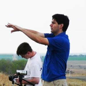
884,970 views • 2 years ago •via X (Twitter)
24 Comments

To be honest, I really wasn't aware of how volatile it looked until it came. Reason being, the weather had been crazy. I'd been chasing more than a half-dozen times since May 18th. And frankly, I was exhausted. I wasn't very interested in forecasting. 2/25
But the day had arrived, and there was a lot of hype. So, obviously, I had to take a closer look. Extreme instability was a given over C OK. But the models now forecasted strong low-level shear to boot. This was the stuff of violent tornadoes. (SPC Day 1 - 1630 UTC) 3/25
The risk had already been assessed at Moderate. And the 1630 UTC outlook had created some buzz about an upgrade to High risk. I remember thinking: "This is like Greensburg -- except during the day." 4/25
The target for everyone was obvious: El Reno. Strong convergence associated with the dryline was implied over W OK -- particularly over Caddo and Washita Counties. Locations downstream of this source of lift were at greatest risk. 5/25
Three cells lined up from southwest to northeast. To me, it seemed like an easy choice: just pick the southern storm. 6/25
Around 4:45 p, the first rain-free base came into view a few miles southwest of Calumet. The storm was clearly consolidating to our west. A wall cloud began to slowly rotate. Cloud-to-lightning was nearly constant. 7/25
Almost an hour later, the first tornado formed where we’d first filmed. It was both rain-wrapped and dust-wrapped. The motion was spectacular. We filmed this segment just north of the intersection of Calumet and Reno roads. 8/25
To the south of the wedge, a well-formed funnel cloud spun. It didn't touch down. But it showed just how much spin was in the atmosphere. 9/25
Then, we got our first taste of deviant motion that day -- an omen of what was to come. The circulation surged to the south, and we had to bail east. 10/25
Just east of Reno and Heaston, we noticed that another circulation had rapidly formed SE of the first circulation. We stopped briefly to take a look. But it was surging too quickly as well, so we were forced to move. 11/25
We went east on Reno again, and pulled off on Brandley Road. The tornado formed. Time was 6:03 pm. 12/25
It quickly became obvious that the tornado wasn’t moving as expected. It wasn’t moving east. It was moving south. We were going to have to scram yet again. 13/25
But I became hypnotized by the tornado. It was putting on a kind of display I’d never seen. My chase partner, Tim, tried to persuade me to get going. It was too close. And cars were coming. 14/25
Fortunately, better sense prevailed. We retreated 1 mile east, then went south on Chiles Rd. To our west, the tornado continued its impressive multiple-vortex display. 15/25
Even so, the tornado was still uncomfortably close. And the driver in front of us was moving *very* slowly. He was in a big, extended cab pickup truck with a large trailer. To this day, I wonder what happened to him. 16/25
Finally at 15th street, we found our east escape route. Yet, almost impossibly, the tornado was *still* on our latitude. We weren't chasing it. It was chasing us. 17/25
Now fully comprehending what was happening, we drove as fast as possible. With the tornado on our heels, Tim accelerated to 60 mph. Instinctively, I turned the video camera off. It was too stressful. We shifted in the inflow. I prayed we wouldn’t lose control. 18/25
As we neared Highway 81 on 15th, I turned the camera back on. The tornado was directly behind us, and closing. But I had no idea how close. Tim believed we'd finally escaped it. But I wasn't so sure. 19/25
As we turned south onto Highway 81 from 15th, the tornado was closer than ever. But it was now a large, black wedge. A line of chaser lights traced back into the funnel. 20/25
Then, the whole circulation filled in – to our southwest. And, if that wasn’t enough, 2 Oklahoma Highway Patrol cars were blocking the *southbound* lane. We didn’t care: this was life or death. So we passed the road block and turned east. One officer followed. 21/25
Now going east on 29th Street, our escape route was blocked again. This time, by a garbage truck. I thought for sure, this was it. 22/25
But then, almost miraculously (for us), the tornado disappeared to the north. It was right next to us the whole time. And then it was several miles way in a moment. Sadly, this was when Twistex was hit. 23/25
Traumatized by the experience, we kept driving. And we kept driving until we were 7 or 8 miles away. We stopped, and caught our final view of the violently rotating mass. 24/25
Here is the route we took that day. All told, we spent more than 15 minutes in the direct path of the tornado. 25/25


