正在加载视频...
视频加载失败
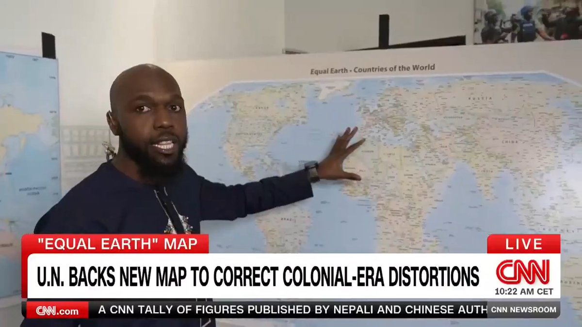
🔥🚨DEVELOPING: There is a new campaign to "correct the map". After ‘new modern scientists’ started reporting that the world map is a lie. ‘We’ve been looking at a distorted version of reality for over 400 years.’

32 条评论

Or we just go back to this one since it’s been around since 1892

The real map is hidden in plain sight

As long as the map says Gulf of America. I’m good.

Wait until they find out the Earth is flat.

Wait is this for real? Are there really that many people today that no longer know about the inaccuracies and disadvantages of different map projections? Of taking a spherical “image” and trying to flatten it? This was basic shit we learned in elementary school for crying out loud.

Here's a link to the full video:

It’s called a Mercator Projection. Not supposed to depict relative size, especially fo countries located near the poles.

There are no correct maps, just variations on how to display a sphere on a piece of paper. Every style of map has its own positives and negatives.

This map is an aviation map. It’s more accurate. Also, the earth is flat

Land Surveyor here, we have been trying to solve this problem for YEARS, even put satellites in space for mapping. GRAVDXXXX, whatever year this datum comes out is supposed to correct these issues in precision. It’s hard when it’s a gum ball you’re trying to make into a perfect shape.

People have been pissy about the Mercator Projection for seventy years. This is nothing new.

TLDR. World is a globe. You are putting a globe on a 2D image which distorts the map. You are welcome.

You get 2 of the 3 folks, but never all 3 at once: Area, Direction or Distance. That's the nature of a round earth on a flat map. That's why there are several hundred projections to choose from. Every map should be built with a purpose in mind.

Is this where we find out Canada is already the 51st state? 🤣

A globe being projected onto a flat surface is called projection and will always distort visual size. There is no lie involved. What IS involved is that some people are so stupid they don't get that. And then there are idiots using it for engagement farming.

FYI

The @constantino is officially back on X. Please help us get this patriot to 70k followers. He is about to break the internet. Bookmark this

Wait until you learn it's flat!

When I was in school, my teacher said we use this map to understand a country’s shape, and if we want the exact size of its territory, we should use a globe. Was that wrong?

Everybody past 2nd grade knows that the Mercator projection isn't accurate, and everyone knows why. This is nothing. Get a job.

It's because the Earth is flat and the nations in the north are much closer together, a fact they tried to hide by expanding their sizes to match nations in the south

“I have a map of the United States... Actual size. It says, 'Scale: 1 mile = 1 mile.' I spent last summer folding it. I hardly ever unroll it. People ask me where I live, and I say, 'E6.” ― Steven Wright

Weren’t you taught that these maps are Mercator Projection maps and that the father from the equator a country is, the more its size was inflated? This is like 3rd grade stuff when you start learning geography..

This is nothing new. There are all kinds of different maps that try to deal with putting an oblate spheroid onto a flat page.

People are so f*cking stupid. We KNOW. Did ya pay attention when they taught us about DISTORTION?! It’s not tough, kids. This idiot looks like a big crybaby that wanders around in public telling everyone “oh I invented that” and proudly believes when he says “oh you copied me”

Life on this earth seems to hold many illusions. Even much of our 'taught' history is not true. Little by little the truth seems to be peeking out here and there. I'm all for it.

It’s the effect of taking a three-dimensional globe and putting it on two-dimensional paper. It’s called map projection, and there are a number of ways cartographers try to project the map so as to minimize distortions. There’s no “correct” way to accurately represent ANY three-dimensional land mass in two-dimensional space. Geography class in 6th grade taught us this.

Notice how they didn’t mention the size or actual shape of Antarctica

JFK Air Force 1 map is epic 😎

If by “new campaign” and “new modern scientists” you mean a long history of cartography debate going back over a century, well then yes, I guess that is “new” on a geological time scale of Earth

This the realist map to exist.

The Earth is a globe, maps are flat it can only be only two ways of a oblate spheroid on a flat map, accuracy of bodies of water, or accuracy of land size. you can't have both. so the popular map we get (left) is the one that facilitates navigation over land accuracy