Video yükleniyor...

Video Yüklenemedi

Ana Sayfaya Dön

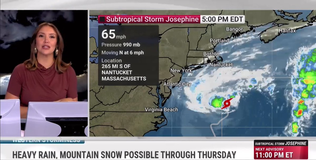
INCREDIBLE developments with Superhurricane Polo, which likely now has winds in the 175+ mph range. It has heated the air enough to lift HALF A TRILLION pounds of air out the middle, driving an incredible vacuum effect that’s resulting in obscene winds.

54,261 görüntüleme • 1 ay önce •via X (Twitter)

20 Yorum

Edie Strom profil fotoğrafı
Edie Strom1 ay önce

There must be crazy waves along Mexican coast.

MarkRad777 profil fotoğrafı
MarkRad7771 ay önce

Water temp of 86 at 190fsw isn’t even believable

FC ZapaPERROS (PoppaBurgundy9) profil fotoğrafı
FC ZapaPERROS (PoppaBurgundy9)1 ay önce

thanks for the video. I have family in Acapulco, Mexico. They got destroyed a couple years ago with Otis. Do you think they are safe from Polo as of today? thanks!

Matthew Cappucci profil fotoğrafı
Matthew Cappucci1 ay önce

Yep! Safe

FC ZapaPERROS (PoppaBurgundy9) profil fotoğrafı
FC ZapaPERROS (PoppaBurgundy9)1 ay önce

I really appreciate the reply!

Berlyn🇺🇸🙏☦️ profil fotoğrafı
Berlyn🇺🇸🙏☦️1 ay önce

I vote for monsoon!

PacificRingOf🌋Fire~🏳️‍🌈~🇺🇦 profil fotoğrafı
PacificRingOf🌋Fire~🏳️‍🌈~🇺🇦1 ay önce

Been waiting since yesterday to see your take on Polo out here in the Western World .. of the Eastern Pacific where El Niño is growing & Polo is blowing minds! Woo Hoo!

Black Pill Pirate ☠️ 🖤🤍 profil fotoğrafı
Black Pill Pirate ☠️ 🖤🤍1 ay önce

@awakensoulslove

O profil fotoğrafı
O1 ay önce

Dance the what?

OnnoWatchingDOGE profil fotoğrafı
OnnoWatchingDOGE1 ay önce

@anttsinc Isn’t this going to be over the migrant walkers?? Oh darn

Dean Lanza profil fotoğrafı
Dean Lanza1 ay önce

I’m sure Super El Niño had much to do with this

adanac-41 profil fotoğrafı
adanac-411 ay önce

And yet...less than 3% of the energy from the warm waters below is converted to air/water movement. The rest all ultimately lost to space. I say this as a way for us all to acknowledge the phenomenal amount of energy involved in these things. Wow.

Issy & Barney's mom. profil fotoğrafı
Issy & Barney's mom.1 ay önce

Whatever happened to hurricanes that wiped out places like palm beach? Rump probably ordered up this 1 to hurt hawaii bc Obama was born there.

Matthew Thomas profil fotoğrafı
Matthew Thomas1 ay önce

Kind of a rough time for a caravan from Central America Hope they make it OK

Texoridian25 profil fotoğrafı
Texoridian251 ay önce

Awesome analysis. Got a follow.

The Free State of FL profil fotoğrafı
The Free State of FL1 ay önce

What's a "Superhurricane", why is it not two words and wasn't this always just called a Category 5?

Quent profil fotoğrafı
Quent1 ay önce

When did storms in the pacific start being called hurricanes and not typhoons?

Sam profil fotoğrafı
Sam1 ay önce

Will it come to Texas?

terminalgu60854 profil fotoğrafı
terminalgu608541 ay önce

Post the vortex message when u get it TU

JOKERSwild profil fotoğrafı
JOKERSwild1 ay önce

Are they using weather weapons against the citizens?? OF CORSE THEY ARE!!

Benzer Videolar

I'd like to take a second to discuss what it means for a storm to be a Category 5. It's a beautiful, mesmerizing, terrifying and awe-inspiring pageant of power and elegance. It's the atmosphere at its most dynamic, raw and extreme. The hurricane has to have an absolutely perfect, undisturbed balance. It's an extremely rare feat. A Category 5 is like a spinning top whirring on a table; even the slightest jiggle can knock it off-kilter – like bumping the table. There must be virtually no shear, or changing winds with height. The upper-level winds around the system must be relatively calm. It's incredible to think that the planet's most furious storms are born out of an abundance of calm. The waters must be exceptionally warm – upwards of 86 degrees – to be replete with "oceanic heat content," or heat energy for the hurricane to draw upon. The warm waters heat and moisten the air above. That air rushes into the building hurricane. As air nears the center of the storm, it expands due to the hurricane's low pressure. That expansion releases heat energy to the environment, encouraging air to rise and powering the storm. In theory, that air parcel (pocket) should cool, but it doesn't. Why? It's still being heated by the oceans below. The ocean is constantly re-heating the lower atmosphere – and energizing the storm – at the exact same rate the air is releasing heat energy into the storm. Most of the moisture in the air condenses and produces rain, releasing even more "latent heat" to the environment. Near the hurricane's center, there's a lot of heat energy. So much so that the air rises, as if in a chimney. That rising air literally lifts air up and away from the surface. There's literally less air, and therefore less air weight, or *pressure*, at the center of the storm. Most Category 5 hurricanes are "missing" about 8-10 percent of the air from the middle. It's that deficit of air that behaves like a vacuum of sorts. Air from outside the storm rushes in to fill the void, like water spiraling into a sink drain. The greater the deficit, the faster the winds. The wind increases exponentially closer to the center of the storm; Category 5 hurricanes have winds over 157 mph. So why doesn't the eye, with the "missing" air, just "fill in?" Because the hurricane is rotating so furiously! The air is flung outwards by the "centrifugal force" at the exact same rate it's being pulled inwards by the "pressure gradient force." The air can never fully reach the eye – and instead it swirls around and around, like water perpetually sloshing around the edges of a toilet. We call that "cyclostrophic balance." Thus, the eye doesn't fill in. The storm charges on. And – until the system is torn apart by disruptive upper-level winds or moves over cooler waters/land – it continues.

Matthew Cappucci

24,804 görüntüleme • 1 yıl önce