Loading video...

Video Failed to Load

Go Home

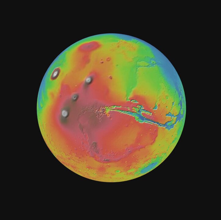
Looks like Cesium just released a new Martian data set on Cesium Ion! Controls and rendering work out-of-the-box with 3d-tiles-renderer, as well. Mars rover integration coming... someday? 🤖 Demo link below 👇 #threejs #webgl #gis #nasajpl

12,754 views • 10 months ago •via X (Twitter)

0 Comments

No comments available

Comments from the original post will appear here

Related Videos

Today, Box is announcing major new AI agent capabilities to let customers tap into the full value of their unstructured data. First, we’re announcing all new updates to the Box AI Studio to make it even easier to build AI agents that tap into your enterprise content for any job function, business process, or industry specific use case. We are also expanding our set of foundational agents that customers will be able to use to work with their enterprise content, including new features like search and research on unstructured data. Next, we’re announcing Box Extract to enable customers to use AI agents seamlessly for complex data extraction from any type of document or content. This makes it easier than ever to pull out data from contracts, invoices, research data, marketing assets, medical charts, and more. Finally, we’re introducing Box Automate, a new workflow automation solution within Box that lets you deploy AI agents across enterprise content-centric workflows. With Box Automate, you can design your business process in a simple drag and drop builder and then drop in AI agents at any step in the process. This ensures agents execute tasks at the right steps in a workflow every time. Best of all, our AI agents and workflow tools are designed to work across any system our customers work within, whether it’s leveraging pre-built integrations, Box APIs, or the new Box MCP Server. Ultimately, all of these capabilities come together to transform how companies can work with their enterprise content. Software has historically only been good at automating work that deals with structured data, which is why ERP, CRM, and HR systems have been mainstays of enterprise software for so long. The data in these systems fits neatly into a database, and the workflows are very ripe for automation. But it turns out most of the work in the world deals with unstructured data. It’s ideating through research documents, working with a client on contracts, reviewing details for a new product launch, looking at a patient’s healthcare record to make a diagnosis, working through due diligence documents for an M&A deal, and so on. For the first time ever, we can begin to bring all new insights and automation to this work with AI agents. At Box, we’re incredibly excited to be on this journey to help customers transform how they work with their most important data.

Aaron Levie

91,863 views • 10 months ago

GeoLibre v1.2.0 is here! GeoLibre is a free and open-source, lightweight, cloud-native GIS platform for visualizing, exploring, and analyzing geospatial data. One application that runs everywhere: in your web browser, as a native desktop app, on your phone, and inside a Jupyter notebook. No account, no server, no cost. Everything runs locally and your data stays private. This release packs in 35+ pull requests of new capabilities. A few highlights: - Run SQL right in the browser. The SQL Workspace pairs DuckDB Spatial with a new in-browser PostGIS engine (PGlite), so you can query layers, local files, and remote URLs without a server. - A smarter attribute table. Add fields, run a field calculator, and explore your data with a built-in Charts panel (histogram, scatter, bar, line, and box plots). - More ways to add data. OpenStreetMap PBF extracts, Cloud-Optimized NetCDF/HDF via kerchunk, georeferenced video overlays, authenticated 3D Tiles, and a Layer builder for custom overlays. - Better visualization. Heatmap rendering, point clustering, and H3 hexagonal grids for spatial binning. - New analysis and routing. A Directions plugin, plus Spatial Join, Select by Value, and Select by Location vector tools. - Print and share. A print layout composer that exports your map to PNG or PDF. - Work faster. A command palette (Ctrl/Cmd + K), global keyboard shortcuts, and undo/redo for layer and style operations. - Built for everyone. New internationalization framework, an accessibility pass with automated axe checks, an installable offline-capable PWA web build, React error boundaries, and Playwright end-to-end tests. Try the live demo: Star it on GitHub: Docs and roadmap: Release notes: #GIS #OpenSource #Geospatial #MapLibre #WebGIS #DuckDB #GeoLibre

Qiusheng Wu

39,608 views • 1 month ago