Video wird geladen...
Video konnte nicht geladen werden
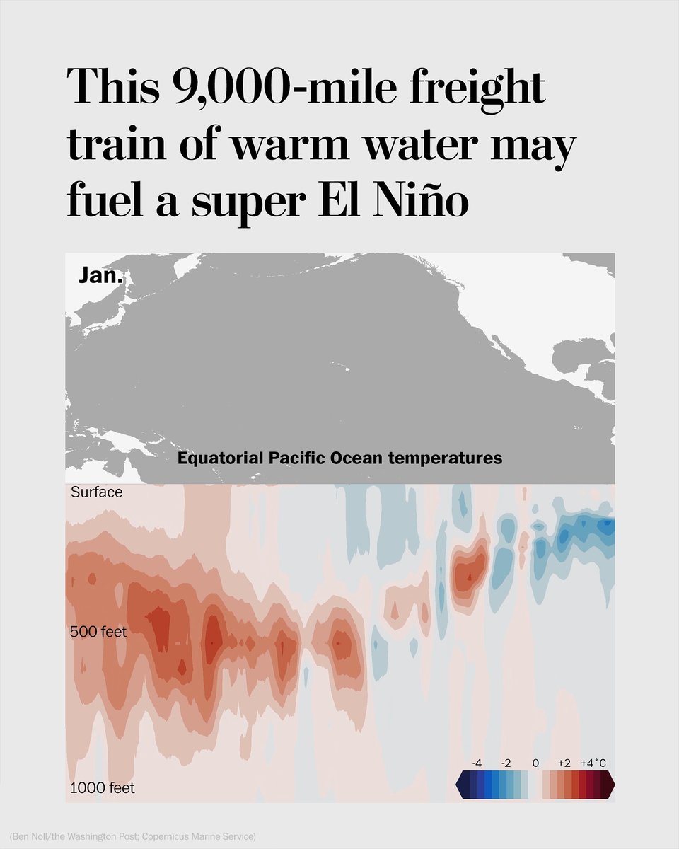
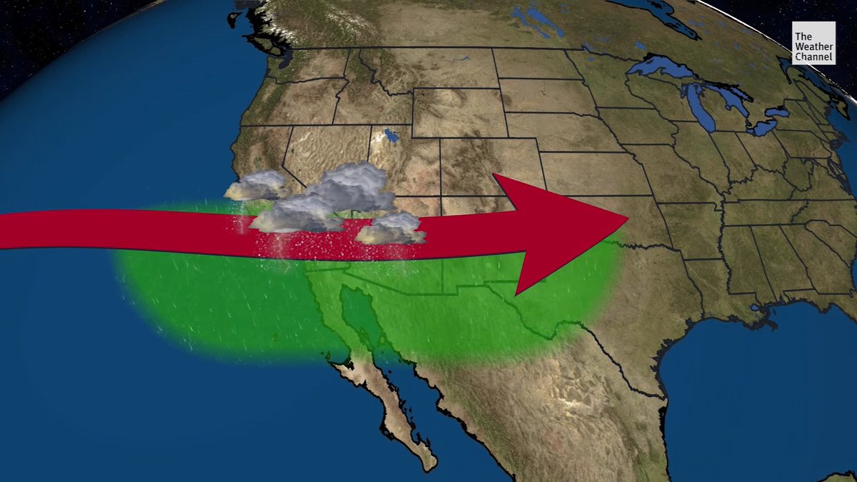
There are some notable warning signs around the developing El Niño, which is expected to strengthen between October and December 2026. According to NOAA: — More than 90% chance of a very strong El Niño — 69% chance it could be stronger than any El Niño recorded since 1950... show more

69,526 Aufrufe • vor 1 Monat •via X (Twitter)
29 Kommentare

Sakaja will need Noah's Ark this time and not those small boats

They aren't ready nor preparing but immediately it will rain, they will take emergency funds, embezzle then expected donation from west.

Companies should start preparing to work from home. It's gonna be messy. Roads will be impassible.

Things we should do👇🏾 Monitor forecasts. Clear drains & reinforce flood-prone areas. Secure insurance, cash buffers and adjust crop plans now — before the Oct–Dec peak.

Is this valid for Kenya?

Yes, it is fully valid for Kenya. In fact, East Africa and Kenya in particular is one of the primary regions globally where an intense El Niño has a direct, severe impact.

@carehsam @grok explain the severe impact on kenya and how the government is dealing with it

El Niño is strengthening and set to bring heavy Oct-Dec short rains across Kenya, with high risk of flooding, landslides, displacement and damage especially in coastal, Lake Basin, eastern pastoral and urban areas like Nairobi. Effects could resemble 2023 (over 100k displaced). Government formed a Cabinet committee under DP Kindiki, mapped 18 high-risk counties via NDOC, and activated a contingency plan for drainage clearance, evacuations, road/bridge reinforcement, pre-positioned supplies and public alerts.

For a loñg time , weather experts have been giving hongwash weather prediction , I hope they're also wrong on this one ,

This is pacific, our rains, from the little knowledge I have in geography, emanate from the Indian ocean. Is the Indian ocean also warm??

Last time it happened the world lost 4% of it's total population

His time stamp is Wednesday 12th. The reports are dated 13th

Haha ,Kenya are ready to blame Ruto on what elnino will destroy 😂

@grok is this likely to affect Kenya?

Gachagua got intel😅😅😅🎉

Well packed information..that's so much

preparation matters more than the forecast itself. Farmers, county drainage teams, transport operators and households all have a few months to plan before the October–December period.

Nairobi isn't prepared for this, even drainage system is still the same. Kenya isn't prepared,they are waiting for people to die of floods.

In Kenya??
Yes, it is fully valid for Kenya. In fact, East Africa and Kenya in particular is one of the primary regions globally where an intense El Niño has a direct, severe impact.

Yeah... Engineered

Hii nairobi tutatii

Okay

Sakaja said Nairobi is a swamp so they is nothing he can do about it.

I don’t know if Kenya is ready for this with our pathetic Potholes and drainage.

Lord have mercy 🙏🏾

The 69% chance of exceeding any event since 1950 means this could outpace the severe 1982-83 and 1997-98 cycles ,,,Combined with human-driven climate change, this event makes it virtually certain that 2026 will rank among the hottest years on record, with temperatures likely surging even higher into 2027

I can't wait for it. Let it come.

This was the perfect time to have had dams constructed. The Arror and Kimwarers would be filled to the brim. But since the politicians we have are totally useless, we are just going to have flooded, impassable roads, deaths and destroyed infrastructure.