Backpirch Weather's banner
Backpirch Weather's profile picture

Backpirch Weather

@BackpirchCrew24,122 subscribers

We provide advanced analysis and live coverage of tropical cyclones worldwide. Follow for hourly updates.

Shorts

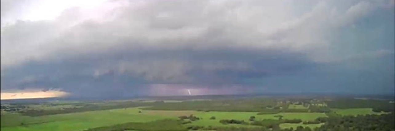
A solitary thunderstorm cell erupting out of nowhere today over southern England.

A solitary thunderstorm cell erupting out of nowhere today over southern England.

666,677 次观看

UPDATE: Category 5 Super Typhoon Ragasa (NandoPH) has just hit a new peak intensity of 180 MPH sustained winds and a minimum central pressure of 905 MBAR. This intensity is approaching the upper limits of what Earth is capable of producing.

UPDATE: Category 5 Super Typhoon Ragasa (NandoPH) has just hit a new peak intensity of 180 MPH sustained winds and a minimum central pressure of 905 MBAR. This intensity is approaching the upper limits of what Earth is capable of producing.

6,039,287 次观看

The amount of convective available potential energy over the Middle East on Thursday is enough for a textbook hatchery of supercell thunderstorms. Where this unstable mass of nearly 5,000 J/kg of CAPE intersects with the dip in the jet stream will determine the greatest threat area for desert tornadoes (most likely in the UAE, Qatar, and Saudi Arabia) and/or strong marine waterspouts over the Persian Gulf.

The amount of convective available potential energy over the Middle East on Thursday is enough for a textbook hatchery of supercell thunderstorms. Where this unstable mass of nearly 5,000 J/kg of CAPE intersects with the dip in the jet stream will determine the greatest threat area for desert tornadoes (most likely in the UAE, Qatar, and Saudi Arabia) and/or strong marine waterspouts over the Persian Gulf.

962,106 次观看

BREAKING: Category 5 Hurricane Melissa’s sustained winds are now roaring at 175 MPH, and the air pressure in her searing eye has sunk to 906 MBAR. The storm is starting to take the northern turn towards Jamaica, and if she intensifies any further, she will begin to approach the mathematical limits of how strong a storm can become in this part of the world.

BREAKING: Category 5 Hurricane Melissa’s sustained winds are now roaring at 175 MPH, and the air pressure in her searing eye has sunk to 906 MBAR. The storm is starting to take the northern turn towards Jamaica, and if she intensifies any further, she will begin to approach the mathematical limits of how strong a storm can become in this part of the world.

2,183,078 次观看

Super Typhoon Bavi appears to be making yet another run at CATEGORY 5 intensity. At 155 MPH (250 kph) and 923 MBAR, her eye has become a gladiator arena of low-level mesovortices and sinking pressures as it continues to clear out again. We are about to see some unbelievable satellite imagery.

Super Typhoon Bavi appears to be making yet another run at CATEGORY 5 intensity. At 155 MPH (250 kph) and 923 MBAR, her eye has become a gladiator arena of low-level mesovortices and sinking pressures as it continues to clear out again. We are about to see some unbelievable satellite imagery.

62,808 次观看

🇲🇵 LANDFALL: Category 5 Super Typhoon Bavi has made landfall over the Pacific Ocean island of Rota with extreme winds of 180 MPH and a core pressure near 900 MBAR, becoming the strongest storm to strike the United States or its territories since the 1935 Labor Day Hurricane, and the most intense by pressure since Hurricane Camille (1969).

🇲🇵 LANDFALL: Category 5 Super Typhoon Bavi has made landfall over the Pacific Ocean island of Rota with extreme winds of 180 MPH and a core pressure near 900 MBAR, becoming the strongest storm to strike the United States or its territories since the 1935 Labor Day Hurricane, and the most intense by pressure since Hurricane Camille (1969).

72,862 次观看

This was an exceptionally ferocious Mesoscale Convective System that exploded over South Dakota earlier today. The hyper-concentrated lightning core generated wind gusts akin to a Category 4 Hurricane and toppled over entire wind turbines when it ripped through Highmore.

This was an exceptionally ferocious Mesoscale Convective System that exploded over South Dakota earlier today. The hyper-concentrated lightning core generated wind gusts akin to a Category 4 Hurricane and toppled over entire wind turbines when it ripped through Highmore.

86,762 次观看

At this time in 2024, the Philippines were in the midst of a 10-DAY span in which they were struck by FOUR consecutive Typhoons. Now this year, the country is reeling from the effects of Kalmaegi (TinoPH) and Fung-wong (UwanPH) both making landfall within the last 5 days.

At this time in 2024, the Philippines were in the midst of a 10-DAY span in which they were struck by FOUR consecutive Typhoons. Now this year, the country is reeling from the effects of Kalmaegi (TinoPH) and Fung-wong (UwanPH) both making landfall within the last 5 days.

1,121,502 次观看

What an intimidating sight Fung-wong (UwanPH) has become over the Philippine Sea as her winds creep up to 65 mph (100 kph). The sprawling size of this budding West Pacific beast is creating an interesting dichotomy. On the one hand, it’s causing Fung-wong to take longer to organize and thus delaying a potential round of rapid intensification (limiting how strong she can get before striking Luzon). But, on the other hand, her larger radius will affect more people in the Philippines and possibly generate a greater storm surge risk near the location of landfall. Even in this latter scenario, which seems to be increasingly more likely, Fung-wong could still explode to a high-end Category 4 Typhoon. Either way, it’s a serious situation we have developing here tonight.

What an intimidating sight Fung-wong (UwanPH) has become over the Philippine Sea as her winds creep up to 65 mph (100 kph). The sprawling size of this budding West Pacific beast is creating an interesting dichotomy. On the one hand, it’s causing Fung-wong to take longer to organize and thus delaying a potential round of rapid intensification (limiting how strong she can get before striking Luzon). But, on the other hand, her larger radius will affect more people in the Philippines and possibly generate a greater storm surge risk near the location of landfall. Even in this latter scenario, which seems to be increasingly more likely, Fung-wong could still explode to a high-end Category 4 Typhoon. Either way, it’s a serious situation we have developing here tonight.

822,599 次观看

BREAKING: Category 5 Hurricane Melissa has achieved a new peak intensity of 180 MPH sustained winds and a core pressure of 896 MBAR. She is officially the 5TH MOST INTENSE Atlantic Hurricane in history and is nearing the maximum theoretical strength a storm can reach in this part of the world. Landfall over Jamaica is just hours away.

BREAKING: Category 5 Hurricane Melissa has achieved a new peak intensity of 180 MPH sustained winds and a core pressure of 896 MBAR. She is officially the 5TH MOST INTENSE Atlantic Hurricane in history and is nearing the maximum theoretical strength a storm can reach in this part of the world. Landfall over Jamaica is just hours away.

737,006 次观看

The zombie inner core of Typhoon Bavi is undergoing some slight re-intensification. An ice cube’s worth of thunderstorms have regenerated a well-defined eyewall, while a ragged, 958 mbar eye has become present on radar. A direct landfall over Ishigaki, Japan is impending.

The zombie inner core of Typhoon Bavi is undergoing some slight re-intensification. An ice cube’s worth of thunderstorms have regenerated a well-defined eyewall, while a ragged, 958 mbar eye has become present on radar. A direct landfall over Ishigaki, Japan is impending.

25,094 次观看

The eye of Fung-wong (UwanPH) is really starting to melt through the icy shell of her CDO now. New, towering thunderstorms are rising up within the inner eyewall as well. On microwave imagery, the Typhoon’s cumbersome core structure is still yet to fully solidify. What we could see in the coming hours, especially after the Pacific sun evanesces below the horizon, is for this new burst of core thunderstorms to freeze the eyewall into a more complete and circular ring around the eye. That would likely jumpstart a true phase of rapid intensification right as Fung-wong enters her final approach to Luzon in the Philippines.

The eye of Fung-wong (UwanPH) is really starting to melt through the icy shell of her CDO now. New, towering thunderstorms are rising up within the inner eyewall as well. On microwave imagery, the Typhoon’s cumbersome core structure is still yet to fully solidify. What we could see in the coming hours, especially after the Pacific sun evanesces below the horizon, is for this new burst of core thunderstorms to freeze the eyewall into a more complete and circular ring around the eye. That would likely jumpstart a true phase of rapid intensification right as Fung-wong enters her final approach to Luzon in the Philippines.

503,606 次观看

Hurricane Melissa, at the moment that she possibly became the strongest Atlantic Hurricane in recorded history, may have had the most extreme detonation of lightning activity ever observed in a storm in this part of the world. Nearly 700 flashes every 60 seconds. What on Earth.

Hurricane Melissa, at the moment that she possibly became the strongest Atlantic Hurricane in recorded history, may have had the most extreme detonation of lightning activity ever observed in a storm in this part of the world. Nearly 700 flashes every 60 seconds. What on Earth.

500,277 次观看

Full satellite loop of two rare, successive thunderstorm cells explosively developing over southern England and the city of London last night.

Full satellite loop of two rare, successive thunderstorm cells explosively developing over southern England and the city of London last night.

53,292 次观看

After her first eyewall replacement attempt resulted in a merger that pushed her to a 165 MPH, 913 mbar peak, Super Typhoon Bavi is finally in the throes of a true EWRC. The thick and persistent nature of her inner core is still protecting a stellar Stadium Effect in the eye, but her infrared satellite signature shows a textbook EWRC structure developing, with a pronounced moat thawing out between the colder, dueling eyewalls. Confidence for a direct or near-direct landfall over the tiny island of Rota continues to increase today; however, Guam should keep a very close eye out for any consistent southward jogs in Bavi’s motion. Even a small deviation could expose the 165,000 residents there to high-end Category 4 or 5 winds.

After her first eyewall replacement attempt resulted in a merger that pushed her to a 165 MPH, 913 mbar peak, Super Typhoon Bavi is finally in the throes of a true EWRC. The thick and persistent nature of her inner core is still protecting a stellar Stadium Effect in the eye, but her infrared satellite signature shows a textbook EWRC structure developing, with a pronounced moat thawing out between the colder, dueling eyewalls. Confidence for a direct or near-direct landfall over the tiny island of Rota continues to increase today; however, Guam should keep a very close eye out for any consistent southward jogs in Bavi’s motion. Even a small deviation could expose the 165,000 residents there to high-end Category 4 or 5 winds.

31,083 次观看

JUST IN: An Extreme Wind Warning has been issued for the Pacific island of Rota as the 180 MPH (285 kph) eyewall of Category 5 Super Typhoon Bavi closes in. The NWS is warning that venturing outside can result in DEATH from flying projectiles. Unreinforced structures will be destroyed, power poles will be snapped or toppled, and island-wide vegetation may be obliterated. If you are on Rota, take cover NOW in a reinforced interior room away from windows. Use mattresses, blankets, or pillows to cover your head and body.

JUST IN: An Extreme Wind Warning has been issued for the Pacific island of Rota as the 180 MPH (285 kph) eyewall of Category 5 Super Typhoon Bavi closes in. The NWS is warning that venturing outside can result in DEATH from flying projectiles. Unreinforced structures will be destroyed, power poles will be snapped or toppled, and island-wide vegetation may be obliterated. If you are on Rota, take cover NOW in a reinforced interior room away from windows. Use mattresses, blankets, or pillows to cover your head and body.

29,002 次观看

JUST IN: Providence, Rhode Island has officially measured their most extreme snowstorm in recorded history, with 32.8 in of snowfall and climbing. The previous record was 28.6 in, set during the Blizzard of 1978. Historic radar loop.

JUST IN: Providence, Rhode Island has officially measured their most extreme snowstorm in recorded history, with 32.8 in of snowfall and climbing. The previous record was 28.6 in, set during the Blizzard of 1978. Historic radar loop.

251,947 次观看

🧵 33 years ago this morning, NWS Miami captured one of the most terrifying radar loops in U.S. History: the eyewall of a Category 5 Hurricane, slicing into a major city while leveling everything in its path. This is the story of Hurricane Andrew.

🧵 33 years ago this morning, NWS Miami captured one of the most terrifying radar loops in U.S. History: the eyewall of a Category 5 Hurricane, slicing into a major city while leveling everything in its path. This is the story of Hurricane Andrew.

510,648 次观看

Almost all Major Hurricanes undergo an eyewall replacement cycle. Melissa never did. She sustained CATEGORY 5 status for 35 consecutive hours, the 8TH longest total duration of Cat 5 winds ever documented in an Atlantic Hurricane, and the longest since Hurricane Irma in 2017. Instead of initiating replacement cycles, Melissa underwent eyewall mergers, which caused only short-lived pauses in her intensification and allowed her to incrementally climb to an extreme strength as she slowly writhed towards Jamaica. It is exceptionally rare to see a high-level Hurricane eye remain so perfectly circular and clear for so many days on end.

Almost all Major Hurricanes undergo an eyewall replacement cycle. Melissa never did. She sustained CATEGORY 5 status for 35 consecutive hours, the 8TH longest total duration of Cat 5 winds ever documented in an Atlantic Hurricane, and the longest since Hurricane Irma in 2017. Instead of initiating replacement cycles, Melissa underwent eyewall mergers, which caused only short-lived pauses in her intensification and allowed her to incrementally climb to an extreme strength as she slowly writhed towards Jamaica. It is exceptionally rare to see a high-level Hurricane eye remain so perfectly circular and clear for so many days on end.

399,320 次观看

🚨LANDFALL: Category 5 Hurricane Melissa has struck Jamaica as the MOST INTENSE LANDFALLING ATLANTIC HURRICANE in recorded history, tying the 1935 Labor Day Hurricane with an Earth-shattering minimum pressure of 892 MBAR. Areas in Jamaica that are impacted by Melissa’s 185 MPH eyewall will likely be left unrecognizable in the aftermath of this storm’s extremely violent passage.

🚨LANDFALL: Category 5 Hurricane Melissa has struck Jamaica as the MOST INTENSE LANDFALLING ATLANTIC HURRICANE in recorded history, tying the 1935 Labor Day Hurricane with an Earth-shattering minimum pressure of 892 MBAR. Areas in Jamaica that are impacted by Melissa’s 185 MPH eyewall will likely be left unrecognizable in the aftermath of this storm’s extremely violent passage.

360,821 次观看

Videos