Video yükleniyor...

Video Yüklenemedi

Ana Sayfaya Dön

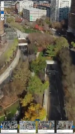
This isn’t just a 3D scene, it’s a geospatial digital twin built with Gaussian splats in ArcGIS. This new GIS layer type brings the physical world into your maps, even adding lifelike detail to vegetation, thin structures, and other complex surfaces.

12,021 görüntüleme • 5 ay önce •via X (Twitter)

0 Yorum

Yorum bulunmuyor

Orijinal gönderinin yorumları burada görünecek

Benzer Videolar

GeoLibre v3.1.0 is here! GeoLibre is a free and open-source, lightweight, cloud-native GIS platform for visualizing, exploring, and analyzing geospatial data. It runs everywhere you do, in the web browser, on the desktop, on mobile, and inside Jupyter notebooks, all while keeping your data local and private. This release brings Mapbox GL JS and the ArcGIS Maps SDK in as full rendering engines next to MapLibre and Cesium, turns the 3D globe into a live situation room with the new God's Eye View plugin, and adds OAuth sign-in for sharing your maps. What's new in v3.1.0 - Four rendering engines: switch the whole workspace between MapLibre, Mapbox, Cesium, and ArcGIS from the View menu. Your layers, styles, popups, and most plugins come along, and GeoLibre remembers your choice. - ArcGIS in 2D and 3D: native ArcGIS services, 3D scenes with terrain and extrusion, PMTiles, Zarr, and NetCDF, plus print atlases, all on the ArcGIS engine. - God's Eye View: watch live earthquakes, satellite orbits, active fires, transit, traffic cameras, live traffic flow, and ship positions on the Cesium globe. - Secure sharing: sign in with OAuth on the web and desktop, and share projects with view, comment, or edit roles, link expiry, passwords, and revocation. - A faster AI Assistant: talk to it with avoice commands, get simple map commands done in under a second, pick OpenRouter as a provider, and find Whitebox tools by describing what you want. - New data plugins: Fields of the World agricultural field boundaries, Satellite Embeddings from foundation models such as AlphaEarth, and IGN LiDAR HD point clouds for France. - More languages and links: Hebrew joins the right-to-left locales, and new ?stac= links open a STAC catalog straight from a URL. This release landed 220 pull requests from 15 contributors, and 8 people made their first contribution to GeoLibre. Thank you to everyone who filed an issue, reviewed a change, or sent a patch. Try it out - Launch GeoLibre Web: - GitHub: - Documentation: - Release notes: #GIS #Geospatial #OpenSource #CesiumJS #ArcGIS #Mapbox #MapLibre #3DMapping

Qiusheng Wu

44,023 görüntüleme • 14 gün önce

GeoLibre v3.0.0 is here! GeoLibre is a free and open-source, lightweight, cloud-native GIS platform for visualizing, exploring, and analyzing geospatial data. It runs everywhere you do, in the web browser, on the desktop, on mobile, and inside Jupyter notebooks, all while keeping your data local and private. This release landed 95 pull requests from 11 contributors, and 5 people made their first contribution to GeoLibre. Thank you to everyone who filed an issue, reviewed a change, or sent a patch. Our first major release makes the Cesium 3D globe a full rendering engine for the whole workspace, brings time-dynamic CZML scenes and native KML to the globe, and lets you save your edits straight back to ArcGIS Feature Services. What's new in v3.0.0 - Cesium as your main map: switch the entire workspace between MapLibre 2D and Cesium 3D from the View menu, and the choice is saved with your project. - Nearly every layer on the globe: COGs, PMTiles, MBTiles, vector tiles, ArcGIS services, I3S scene layers, LiDAR point clouds, and Gaussian splats all render in 3D, with extruded polygons and true elevation for 3D vectors. - Dynamic 3D scenes: load CZML for orbits, trajectories, and moving objects that play along the globe clock, open KML and KMZ with their original styling, and add Cesium Ion assets such as OSM Buildings by id. - Your tools work in 3D too: screenshots, print layouts, video and camera tours, the Elevation Profile, and the Sun, Atmosphere, Flight Simulator, and weather plugins. - ArcGIS write-back: edit a Feature Service layer in GeoLibre and save additions, changes, and deletions back to the service. - Editable SVG print layouts: export a layout and fine-tune the title, legend, and scale bar in Inkscape or Illustrator. - Smarter rasters and new data sources: viewport-based raster stretch, persistent layer filters from Select by Expression, a Portolan catalog browser, OGC CSW catalog search, and a USGS NLDI panel for tracing river networks. Try it out - Launch GeoLibre Web: - GitHub: - Documentation: - Release notes: #GIS #Geospatial #OpenSource #CesiumJS #3DMapping #MapLibre #GeoLibre

Qiusheng Wu

64,117 görüntüleme • 26 gün önce