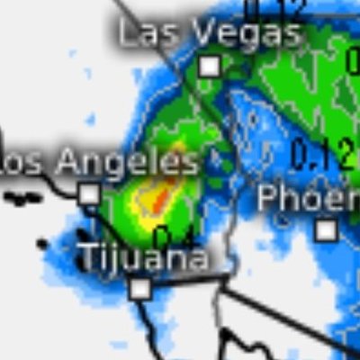
**Severe Thunderstorms, a tornado, snow and flash flooding all... expected after 12am tonight through SundayMorning*** After mainly light rain avriss the region the past 24 hours, the 1st sigba of a much lote intense, slow moving and significant band of flooding rains and possibke Severe Thunderstorms cam be seen slowly developing to the south of San Diego with the most intense activity tomorrow afternoon. There us a growing rise if weak Tornados, especially along our coast but as always will be isolated. Still if one touche down there could be localized significant damage. Significant flooding is possible for all of SoCal but especially our burn scars abd Desert regions where widespread road closures are possible . Significant snowfall tonight may impact our highest mountain highways above 7500ft where 1ft+ is likely. #CAwx #Rain #Flooding #LosAngeles #BigBear #SanDiego #SoCal #Thunderstorms #Snowshow more
SoCalWeather.net
16,955 görüntüleme • 8 ay önce
Major Storm to Impact Southern California As of Wednesday,... February 12, 2025, at 6:50 PM PDT, the latest infrared satellite imagery confirms that the incoming storm system is fully developed and on track to deliver severe weather across Northern and Central California tonight into early Thursday afternoon. The system is intensifying rapidly, with a powerful surface cold front expected to sweep through San Luis Obispo to San Diego counties, bringing damaging winds, torrential rainfall, and the potential for severe thunderstorms. Key Storm Impacts: "Big Thursday" – A Major Weather Event • Extreme Rainfall Rates – 0.50 to 1.5 inches per hour, increasing the risk of urban flooding, flash floods, and mudslides, particularly in burn scar areas of Los Angeles County. • Damaging Winds – Southerly gusts of 45-65 mph, capable of toppling trees, damaging weak structures, and causing widespread power outages. • Severe Thunderstorm & Weak Tornado Potential – The latest HRRR model data (18Z, 0Z) indicates the presence of a squall line, increasing the risk of isolated severe thunderstorms and weak tornadoes between 12 PM and 10 PM Thursday. • Scattered to Widespread power Outages – Areas at risk include the San Fernando Valley, Santa Clarita Valley, Ventura County, and portions of Los Angeles County, where infrastructure could be severely impacted. • Urban Flooding Concerns – Locations such as Downtown Los Angeles, Pasadena, Altadena, and Pacific Palisades will experience rapid runoff and potential roadway flooding, creating hazardous travel conditions. The Seriousness of the Situation This storm is shaping up to be one of the most intense weather events of the season, posing a significant threat to life and property. Residents in Los Angeles County and surrounding areas must prepare for prolonged heavy rainfall, high winds, possible power outages, and dangerous road conditions. Authorities urge residents to stay indoors, avoid unnecessary travel, and prepare emergency supplies. Those in flood-prone and burn scar areas should be especially vigilant for potential debris flows and flash flooding. This is a rapidly evolving situation and further updates in the next 24 to 30 hours. #CAwx #CaliforniaStormsshow more

Jason D Farhang
30,044 görüntüleme • 1 yıl önce
Christmas Eve and Christmas Day feature the most impressive... severe thunderstorm setup I’ve seen along the California coastline in at least a decade. The first round of isolated severe thunderstorms will come ashore tonight, bringing the threat of a isolated tornado and severe wind gusts over 60 mph from the Central Coast up to Humboldt County. The severe weather threat then expands into the Central Valley during the afternoon, California’s tornado alley, with the potential for isolated tornadoes, damaging winds, and even large hail. The threat then shifts south into Southern California tomorrow, where isolated severe wind gusts and a brief tornado will be possible. However, Christmas Eve into Christmas morning features the most potent severe weather environment of the week and could lead to a severe thunderstorm outbreak along the coastline from the Central Coast up to the North Coast. The combination of strong low-level and deep-layer shear with sufficient instability is rarely seen in this part of the world. I seriously cannot recall seeing Significant Tornado Parameter (STP) values exceed 3 along the California coastline. The peak threat window appears to be from 10 PM Thursday to 8 AM Friday. It would not be out of the question to see a Severe Thunderstorm Watch issued Christmas Eve night with the potential for a couple tornadoes and scattered severe wind gusts. I also believe this may be the first time on record that San Francisco has been placed under a Marginal Risk for severe thunderstorms in the Day 1–3 NWS Storm Prediction Center Convective Outlooks.show more
Colin McCarthy
68,544 görüntüleme • 6 ay önce
🚨 California is about to get PUMMELED by Flooding... Rain as a powerful Atmospheric River targets the state. ⚠️The highest rainfall totals will be in Southern California, where the National Weather Services has issued a RARE HIGH RISK of flooding for Los Angeles and surrounding areas. 🌧️Rain Totals could reach 10 inches or more, which would normally be beneficial, but falling in such a short time could lead to dangerous and potentially catastrophic flooding. Our California brethren, especially across Southern California, should begin preparing now for days of flooding rain. Pay close attention to local weather warnings, and if evacuation orders are issued, do not wait. The West Coast is once again bracing for another major storm. 🌧️❄️show more

Brady Harris
309,467 görüntüleme • 6 ay önce
Saturday April 18, 2026, 7:50 PM: The latest satellite... shows an incoming robust late-season Pacific storm into all of California starting Monday at 10PM to Tuesday at 7PM. The 545 DM low axis, approximately 240 miles northwest of San Francisco, continues to intensify greatly due to escalating warming of the Pacific, and a piece of embedded impulse from a typhoon near Guam will eject into this system. The main low axis will form a secondary low near San Luis Obispo to western Los Angeles counties late on Monday afternoon. This actually may further escalate the stronger surface cold front that will maintain all way through Southern California especially Los Angeles County. Perhaps even grazing Riverside, San Bernardino, and San Diego counties. In addition to this, there will also be severe thunderstorms that will be associated with the system, especially up into the Bay Area just south of Sacramento and Fresno. There could be isolated tornadoes as well on Tuesday afternoon. I'm watching this developing situation closely in the next 24 - 36 hours. The snow levels remain 5,500 feet for Lake Tahoe and Mammoth Mountain and that includes Yosemite Valley, where snowfall accumulation can reach 12 to 36 inches of snow by Wednesday afternoon. #CAwx #winterisbackshow more
Jason D Farhang
15,300 görüntüleme • 3 ay önce
Wednesday, April 3, 2024, 5:42 PM PDT: All systems... are a go for a cold and unseasonable Gulf of Alaskan April storm. Strong thunderstorms have already developed near Redding, California, and a series of embedded impulses are rotating around the main low axis off the coast of Humboldt County this afternoon. This storm system will undergo a brief 12 to 24-hour intensification process before hitting San Francisco, Santa Rosa, and Sacramento late Thursday afternoon. It will bring isolated strong to severe thunderstorm conditions. A large surface cold front will develop late Friday morning as the low axis trajectory slides down the coast towards Pismo Beach, California by Friday at dawn. Severe Weather Risk In Central And Southern California on Friday. The atmospheric conditions will become increasingly unstable, giving way to thunderstorms from central California to San Diego. The cold pool of air aloft, at minus 28 Celsius above 25,000FT, will create volatile weather conditions with the possibility of pea-sized hail and brief heavy rainfall in some areas. The air mass will be very cold, supporting a dusting of snow near the Grapevine and Cajon Pass. Temperatures will drop into the 40s and 50s, and the 30s near the mountains by Friday midday. As snow levels have been trending downward and hit rock bottom, there may be some isolated areas at 2,000-foot elevation along the San Gabriel’s and parts of the San Bernardino mountains that could see a dusting of snow. Even some dusting of snow in the high desert cannot be ruled out. There is a high confidence of elevated water spouts developing from San Luis Obispo to San Diego coastal zones, especially since one of the embedded disturbances will arrive on Friday from 11 AM to 7 PM. This is also the best opportunity for ample early April sun angle, which will give way to stronger convection across our region. I'm closely monitoring this developing situation in the next 24 hours. #Californiastorms #ElNiño #April2024show more

Jason D Farhang
23,214 görüntüleme • 2 yıl önce
❄️ SNOWFALL REPORT: Week of 1/18 – 1/25 ❄️... This is a another BIG one. A HIGH IMPACT Winter Storm could develop late this upcoming week, with the potential to bring Heavy Snow and Ice to parts of the country. 🌨️ The heaviest Snow will likely fall on the north side of this storm Friday - Sunday, wherever it ultimately tracks. As we move through the week, I would not be surprised to see Winter Storm Watches and Warnings issued as it becomes more clear where this storm will setup. ❄️When it comes to exact locations and Snow totals, we are still WAY too far out to pin that down. That said, the most likely SNOW ZONE appears to be somewhere within the Tennessee and Ohio Valleys, though this will almost certainly shift as we get closer. ❄️Elsewhere, the Midwest will see a few rounds of light to moderate Snow Monday through Wednesday as a series of Alberta Clippers pass through. These should be minor systems, generally producing a few inches. ❄️ Boston, NYC, and parts of the Northeast will start the week with a healthy dose of Snow, with 4-5 inches possible by Monday morning. 🏔️ Out West, the Rocky Mountains from Colorado through Wyoming, Montana, and Idaho should pick up significant Mountain Snow, with over a foot possible in higher elevations. 🏔️The Cascades in Washington and Oregon will also see Snowfall, with a few feet possible in favored areas. ❄️The MAIN THING to remember this week: whoever gets hit by the late week Winter Storm could get A LOT of Snow, but there will also be plenty of busts nearby. That’s the nature of these storms. 👀 I’ll be watching this late week storm LIKE A HAWK 🦅and will post updated maps as details become clearer. ❄️ Get ready, my brotheren. This is shaping up to be an exciting week of weather tracking. May the odds of Snow be ever in your favorshow more
Brady Harris
642,270 görüntüleme • 6 ay önce
SIGNIFICANT SNOWFALL POTENTIAL FRIDAY NIGHT ******1ST CALL MAP****** 🎄... Merry Christmas to YOU!!! A pretty sizable snowstorm is expected across the region Friday night, with snow developing as early as Friday evening. I am very confident in a widespread 6–10" snowfall for a large portion of the Tri-State area, with lower confidence closer to NYC, Long Island, and the Jersey Shore where mixing remains a concern. At this time, I am keeping some mixing in play in central NJ/Long Island, but I’m not totally sold on how aggressive it becomes. While 4–6" looks like a very solid floor, several areas could easily boom to 6"+ if colder air locks in faster and holds longer than currently modeled. ZONE 1 – 6–10" OF SNOW This is the zone where cold air damming will be most prevalent, allowing snow to remain all snow for the duration of the event. Expect higher snow ratios, which could allow many areas to push toward double-digit totals, especially under any persistent banding. I could easily pull this zone into NYC and Nassau County as we see more model data. ZONE 2 – 4–6" OF SNOW This zone will likely start with heavy, wet snow, before transitioning to a lighter, fluffier snowfall as colder air works in. Some compaction is expected with lower snow ratios, but additional snow and mesoscale banding could still drive totals toward or above 6" in spots. ZONE 3 – 2–4" WITH MIXING This zone remains VERY uncertain. I could make a strong argument that cold air advection dominates, keeping this mostly snow and allowing totals to reach 4–6". However, low-level warm air transport on an easterly wind may introduce sleet, especially along the Jersey Shore (east of GSP) and into Suffolk County, which would eat into accumulations. I’ll be watching trends closely as this is shaping up to be a sharp cutoff storm where small shifts could have big impacts. 📺 On TV now with the latest on PIX11 Newsshow more

Mike Masco
242,183 görüntüleme • 6 ay önce
It doesn’t take much water to create a dangerous... situation. Just a few inches can lift a vehicle off the roadway and put lives at risk. As storm systems move through San Bernardino, Inyo, and Mono counties, our region is seeing a mix of rain, mountain snow, runoff, and localized roadway flooding. Combined with increased holiday travel, conditions can change quickly—especially in low-lying areas, desert washes, and mountain passes. Please keep these safety reminders in mind: • Never attempt to drive through standing or flowing water. • If water is covering the roadway, Turn Around, Don’t Drown and choose a safer route. • Expect delays during the holiday travel period and allow extra time to reach your destination. Flooded roads can be deceptive and deadly. Slowing down, staying alert, and making cautious decisions protects not only you and your passengers, but everyone sharing the road. Arriving safely is always worth the extra time. 📍 Sheep Creek Rd x Phelan Rd. #TurnAroundDontDrown #StormSafety #HolidayTravel #CALFIRE #SanBernardinoCounty #InyoCounty #MonoCountyshow more

CAL FIRE BDU
73,298 görüntüleme • 6 ay önce
❄️ SNOWFALL REPORT: This Week (12/1) More snow is... on the way as a series of storm systems sweeps across the country, bringing brutal cold temperatures behind them. Here’s a breakdown of each Storm ⬇️ 1️⃣Everything kicks off Tuesday morning with our first storm, bringing widespread accumulating snow from the Ohio Valley into the Northeast. The jackpot looks to be the interior Northeast, where 4-8” are possible. Along the coast (NYC, Boston, DC), expect mostly rain. 2️⃣Later in the week, a second storm may take a similar track, bringing another round of accumulating snow to the Northeast. Details are still TBD, but snow is definitely on the table. 🥶Behind both storms, the Polar Vortex will dip into the U.S., delivering a surge of very cold air - highs in the 20s, 30s, and 40s across the eastern U.S. It’s going to be a fun week 😎❄️show more
Brady Harris
740,364 görüntüleme • 7 ay önce
🚨Models are starting to LOCK IN on where the... Heaviest Snow and Strongest Winds will be with our upcoming Bomb Cyclone. ✅ Every Weather Model is now on board with a DUMPING of snow across the Carolinas, with some spots getting several inches and some spots getting up to 1 Foot! ❄️ The highest Snow Totals will fall closest to the center of the Nor’easter in coastal North Carolina and Virginia, where up to a foot of snow is possible. 🎯 Cities like Raleigh, Wilmington, Virginia Beach, and the Outer Banks will see Blizzard conditions for much of the day Saturday as snow piles up and winds really start to CRANK. ⬅️ Further inland, Heavy Snow is also likely in Charlotte, Columbia, Greenville, and Asheville, with totals generally in the 3–6 inch range. 🌨️ Elsewhere in the Northeast, models currently agree this storm largely misses you, with lighter snow of 2–4 inches possible in Delaware, Maryland, and into Nantucket. ➡️⬅️ There is still time for small east or west shifts, but each new model run lowers those odds. ⚠️ We know this will be a big storm for our Carolina brotheren. Winter Storm Watches are already out, and several may be upgraded to Blizzard Warnings by Friday. 🔒 Lock in, my brotheren. A Blizzard is coming. ❄️🌬️show more
Brady Harris
50,135 görüntüleme • 5 ay önce
Today, there is wet snow with rain in many... Ukrainian regions. The temperature at night gets below zero. It is already snowing in Kharkiv. The heating is not on in several cities. Ukraine is getting ready to face the hardest winter in our history. There may be no electricity in Ukraine for 20 hours a day in winter if Russia strikes our critical energy system and the weather is cold. As of today, blackouts are most probable for 8-14 hours a day. We are expecting a very harsh winter. I don't know if the people in their apartments will be able to survive the prolonged heating and power cuts in severe cold weather. Russia is doing everything to make Ukrainians flee their country. 📹: Kharkiv todayshow more

Anton Gerashchenko
794,823 görüntüleme • 1 yıl önce
⚠️ I’m not liking the way this Winter Storm... is trending for our Texas brotheren.... One aspect that isn’t being talked about enough is the combination of significant Ice Accumulations followed by days of Brutal Cold. If Texas were to receive even a fraction of the ice currently being shown, widespread power outages would become a real concern. With frigid air rushing in behind the storm, temperatures could remain at or below freezing for days, making recovery much harder. This will not be as cold as the deadly Winter Storm of 2021, but the dangerous combination of ice and prolonged cold will still be there. 🌡️ Some areas could see temperatures 30 to 40 degrees below average after the storm, which would compound impacts if outages occur. I’m not saying panic, my Texas brotheren, but this is a situation worth paying attention to and preparing for if current trends hold. 👀 I’ll be watching this LIKE A HAWK 🦅show more

Brady Harris
228,272 görüntüleme • 6 ay önce
Hope will always have a home with us. As... I hinted at this morning, I got a sense from the property manager that this tear down ranch house may not be available as a rental for much longer… we could try to buy the lot but the process is long and complicated…and there would be no house standing while it all played out. And we’d be competing against a bunch of local developers. We went in another direction. To be honest this is a plan/project we’ve been working on for the last six months. I’ll cut to the chase. We bought a house under construction four doors down. It’s already part of Hope and the herd’s habitat so the adjustment should be fairly smooth. If you look at the first photo shot from the top floor of our new house you can see our small ranch rental between the blue house and light brown one. We’re moving in. Some of our deer friends have already joined us. See short video shot from our new rear deck.show more

Claude Taylor
24,236 görüntüleme • 8 ay önce
No one is coming to save us There are... no political solutions, our heroes are dead and all our enemies are in power If we fail, in 100 years there will be no White people left… have you considered what that means? It means 3rd World conditions for the entire planet It means lawless anarchy 1st World Western Nations offset the 3rd World through aid, charity, and donations Without us, instead of continuing their upward trajectory they would begin to deteriorate fast Our people turn the world from a savage jungle into a place of order There are no 1st World non-white Nations China is still developing in a lot of ways and Korea and Japan have dangerous population declines as well Without the amount of people it takes to run the infrastructure you get an expedited breakdown of society Of course our White children will be hated and blamed for the failures Mobocracy will rule, reason will cease, and we’ll return to the stone ages not because of nuclear war but because White people disappearedshow more

Christian Ascania🌞
70,540 görüntüleme • 6 ay önce
Hurricanes and wildfire: #hawaii #maui #wildfire #LahainaFire The winds... brought the power poles and transformers down, that sparked fires, communications went down, then 80MPH gusts fanned the flames across the landscape. A perfect storm… but why?! If you look at the National Interagency Fire Center’s Predictive Services, which we have been covering, they knew Hawaii would be ready for significant fire growth as far back at Spring. “El Niño will be the driving factor.” There was a La Niña/El Niño switch this spring… El Niño has developed in the equatorial Pacific Ocean, and rapid warming continues in much of the ENSO region, especially in the central Pacific with continued anomalous warmth off the coast of South America. Above normal sea surface temperatures are observed in all ENSO regions. Most forecast guidance depicts continued warming through summer, with El Niño conditions forecast to continue into winter. The Climate Prediction Center forecasts a greater than 95% chance of El Niño conditions continuing into winter, with a 56% chance of a strong El Niño developing this fall. Other teleconnection patterns, such as the Madden Julian Oscillation (MJO), Pacific Decadal Oscillation, and Pacific-North American Pattern may influence weather and climate during the outlook period, but El Niño will be the main driver…show more
The Hotshot Wake Up
3,699,416 görüntüleme • 2 yıl önce
Sunday, February 23, 2025, 3:00 PM PDT: A significant... shift in the pattern from 90° temperatures in the next 2 to 3 days across much of Southern California and the southwest. A shift in the main Pacific Jet stream axis is just approximately 230 miles due west of the Hawaiian islands and Marshall Island corridor. A series of strong Pacific storms that are trending one right after the other this particular series of storms may produce similar to what we had a couple of weeks ago that brought significant rainfall to our region. I’m watching the details as this emerges this upcoming week as we transition into March 2025. This is also known as the pinnacle of Hollywood’s award season, which is on March 2, 2025, which is next Sunday already. Higher confidence is growing in potential for at least over an inch of rainfall. Possibly higher rainfall amounts first week of March 2025. This still is being looked at closely in the next 24 to 36 hours from San Francisco to San Diego, California. The hardest-hit areas trending are San Luis Obispo to Los Angeles counties. Many burn areas from Pacific Palisades to Altadena will have to keep a close eye on this developing weather situation over the next few days as this evolves. #CAwx #CaliforniaStormsshow more
Jason D Farhang
14,714 görüntüleme • 1 yıl önce
SUNDAY SNOWFALL — 2ND CALL ❄️ This setup shares... similarities with today’s event, where lift and timing matter more than storm track of the coastal. While the primary coastal low stays offshore, a secondary zone of strong dynamics along the leading edge of arctic air will be the driver for snowfall Sunday. That zone favors Long Island and central NJ Sunday afternoon into the evening, supporting a widespread 2–4” snowfall. The BOOM potential remains over LI if the trough axis can swing from neutral toward slightly negative tilt — a signal consistently shown by the AI guidance, which has been notably steady with this idea. In this scenario your moisture transport off the Atlantic Ocean can be enhanced causing more surprises. I am being cautious on that. ❄️ZONE 1 | NW NJ / Hudson Valley Snow arrives earlier here with colder air already in place. Snow ratios will be higher, allowing coating–2” in most spots. With the front nearby at onset, isolated 3” totals can’t be ruled out, especially near I-87 and areas just east. ❄️ZONE 2 | Interior NJ, NYC, SE NY, CT (away from the immediate coast) This is the core 2–4” zone. While that sounds modest, this is a dynamic-driven snow, meaning totals could fluctuate sharply over short distances. I believe most of NE NJ, NYC, SE NY, and much of CT reach at least 2”, with localized overachievers possible. ❄️ZONE 3 | Coastal NJ & Southern Long Island Mixing remains the wildcard here. Small temperature and wind shifts will have an outsized impact, making this zone highly volatile and lower confidence overall. ⚠️ BOOM POTENTIAL: ALL OF LONG ISLAND & SE CT If snow banding locks in Sunday evening, this area could see an extended period of steady snow. In a perfect scenario, 4–6” is achievable, but confidence in that outcome is still low. More on the PIX11 News at 10pmshow more

Mike Masco
20,050 görüntüleme • 6 ay önce
Monday, July 21, 2025 at 12:20 AM PDT: Southern... California's weather this week remains relatively quiet compared to the extreme flooding impacting other parts of the country. However, eyes are now turning toward a developing tropical system off the coasts of Acapulco and Baja California. This system has the potential to enhance monsoonal moisture and influence our region between July 29 and August 6, with the most likely impacts occurring in early August. This period typically marks a westward shift in the monsoonal high-pressure axis, allowing deeper moisture to funnel into Southern California. Our region already saw a brief surge of monsoonal activity late last week (Thursday and Friday), signaling that the pattern may be primed for additional stronger robust events trending. What makes this setup notable is the potential interaction between monsoonal flow and tropical moisture, which could lead to a stronger and more sustained influx of moisture than we've seen so far this season and the escalation of warming of the Pacific Ocean continues. The latest forecast models in the last 72 hours have had consistent and comprehensive satellite trends that continue to be monitored closely as more details emerge over the coming days. Further updates will be issued as confidence increases regarding the track and strength of the strong monsoonal inverted influx and its potential impacts on the region. #CAwx #Monsoon2025 #HurricaneSeasonshow more
Jason D Farhang
11,792 görüntüleme • 1 yıl önce
*SEVERE geomagnetic storm possible with U.S. aurora borealis display*... *Northern lights possible at mid-latitudes early Sunday morning or Sunday night* *Specifics TBD – map coming later today* On Friday evening Eastern time, a major solar flare occurred from sunspot #4100. A sunspot is a bruise-like discoloration on the sun that throbs and pulsates with energy. Following the solar flare, which is a flash of light and radiation, a significant CME — or coronal mass ejection — was hurled directly toward Earth. Imagine a shockwave of magnetism and high-energy particles rippling through space like an interstellar tsunami. It’s heading for us at speeds around 1,200 miles per second — that’s very fast! We know it’s Earth-directed because our sensors indicate a “full halo” CME. See the solar material appearing to fan out in all directions? That’s an indicator it’s Earth-bound. It’s like if a train is coming right at you — you’d only see the train getting bigger. Once this electromagnetic shockwave reaches Earth, the energy will be absorbed and dissipated by our magnetic field. It will be transformed into visible light — the aurora. Since there’s a LOT of energy, we’ll probably get the aurora borealis (the northern lights) down to the mid latitudes. This could mean parts of the central United States, the Midwest, the Mid-Atlantic and perhaps as far south as northern California. There’s even a chance that parts of the Mid-South could see the aurora IF a direct impact occurs and the orientation of Earth’s magnetic field cooperates. Scientists at the Space Weather Prediction Center in Boulder, Colorado are working to iron that out.show more

Matthew Cappucci
10,381 görüntüleme • 1 yıl önce