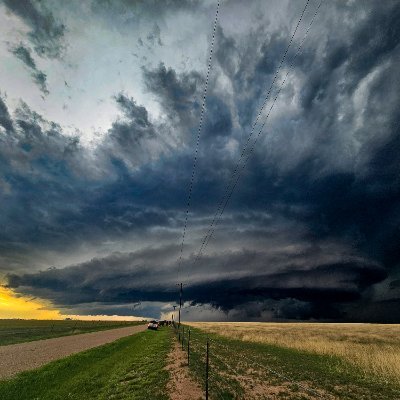
This was an exceptionally ferocious Mesoscale Convective System that... exploded over South Dakota earlier today. The hyper-concentrated lightning core generated wind gusts akin to a Category 4 Hurricane and toppled over entire wind turbines when it ripped through Highmore.show more

Backpirch Weather
86,762 views • 19 days ago
Storm following loop of the intense MCS/?Derecho? through South... Dakota this morning. Wind gusts up-to 131mph and a couple tornadoes were spawned from this system! #SDwxshow more
Hunter Hurley
26,088 views • 19 days ago
Toppled Turbines: those wind turbines on 128 in Gloucester... have been dismantled and no longer dot the landscape of this seaside community…city leaders felt it was time for them to go after various problems over the years including a blade that fell off #7Newsshow more

Steve Cooper
90,054 views • 3 months ago
I love the term #bombogenesis - coined in a... white paper in 1980. It sounds scary, but really it means “rapidly intensifying storm”. The reason it matters is, the faster a storm deepens (pressure drops) the stronger the wind gusts due to an imbalance in pressure - it forces air to move quickly. So when meteorologists say a #storm is a bomb it means something. In this case gusts over the ocean will reach 100 mph, with coastal gusts to #hurricane force 75 mph. #blizzard #blizzardof2026show more

Jeff Berardelli
33,815 views • 4 months ago
Major Hurricane #Humberto has reached Category 5 today! ⚠️... Off the coast of Florida, the future Hurricane #Imelda is now forming. However, the powerful Hurricane Humberto is expected to alter its path and deflect it over the Atlantic, so it is still not anticipated to reach the shoreline. 🙏 This rather unique development is captured in the wind animation for the next four days:show more

Ventusky
65,169 views • 9 months ago
Nice sunny day in Bavaria. Another day when all... these wind turbines stand perfectly still, as expensive land decorations without generating a single watt of electricity. I saw more than 50 wind turbines today while driving and hiking through the landscape. Not a single one of them was turning. I used to support the so called "renewables". But having eyes to observe and a brain to think make me doubt the renewable maximumist narrative. Southern Germany is simply not suitable to build more wind turbines, because it is just not windy enough. No amount of government mandate or subsidies can change that. Green's 100% renewable fantasy is an expensive war against nature.show more

Dr. Dale Wen
53,871 views • 3 months ago
A large majestic bird is struck and killed by... an "environmentally friendly" wind turbine. If this bird had died as the result of an oil spill, you can be absolutely certain it would have been broadcast all over the MSM. Hundreds of thousands of bats and birds are killed by wind turbines every single year, in the U.S. alone. But that goes against the agenda, so the media says nothing.show more

Wide Awake Media
2,854,443 views • 2 years ago
Ever seen someone tee it up this high? With... a low ball flight! If I did this, my clubhead would be damaged beyond belief. A friend of mine is an absolute cracker of the ball. Hits an awesome drive over and over, 250+ yards, wonderful ball flight that stays out of the wind. And tees the ball up an inch over the entire clubface!show more

Rick Golfs
147,194 views • 1 month ago
⚠️A POWERFUL Bomb Cyclone is set to slam Europe... on Thursday as it tracks through the English Channel, bringing Heavy Snow, Strong Wind, and Rain. 💨 Hurricane force Wind Gusts are possible along parts of the French coast, with wind gusts expected to exceed 70mph as the storm rapidly "bombs out". ❄️ On the back side of the storm, Heavy Snow and Blizzard Conditions could develop across parts of England, as cold air wraps in behind the system and winds absolutely CRANK. ⚠️ This is a high impact, fast moving storm, capable of producing major travel disruptions, power outages, and dangerous conditions across multiple countries. Normally, I stick to US Weather, but this will be a very impactful Storm for our European Brotheren so I thought it was worth covering. Heads up my European Brotherenshow more

Brady Harris
143,705 views • 6 months ago
🚨🇺🇸 TRUMP ADMIN SLAMS WIND TURBINES OVER BALD EAGLE... DEATHS… BUT CUTS OIL & GAS RULES The Interior Department demanded full legal protection for bald eagles from wind energy projects - the same law Trump tried to gut 4 months ago for oil and gas companies. Critics say it’s less about saving America’s bird and more about whacking an industry he’s disliked since losing a legal fight over a Scottish wind farm that spoiled the view from his golf course. While wind projects face extra scrutiny for eagle deaths, coal, oil, and gas keep getting fast-tracked, even under weaker wildlife protections. It’s a bird, it’s the law… but apparently, it depends on whose project is killing them. Source: NYT, Rock Bshow more

Mario Nawfal
316,652 views • 11 months ago
Super Typhoon Sinlaku’s 185 MPH peak strength a few... hours ago was very close to her Maximum Potential Intensity. In other words, Sinlaku generated the highest possible sustained wind speeds that a storm could theoretically produce over these specific water temperatures and atmospheric conditions in the West Pacific. Historically speaking, this is extremely rare, and similar to what we saw with Hurricane Melissa last year in the Caribbean Sea.show more
Backpirch Weather
82,130 views • 3 months ago
HELENE will be a MAJOR impact well inland. Georgia,... the western Carolina's, Tennessee and Kentucky! This is actually a rare meteorological setup for this side of the world. This is called the "Fujiwara Effect" -- notice how major hurricane Helene gets boomeranged NW and around a low pressure aloft over west TN. Think like two planets orbiting each other than consolidating into one. This complicated, and uncommon meteorological process will help keep the forward speed of the remnants very high. Destructive wind gusts throughout central Georgia, Atlanta area and east TN. This won't be like Ike remnants in 2008 in TN/KY but I think will surprise many with the inland wind gusts Friday well inland. I could see 50-60 MPH gusts all the way to the Ohio River solely due to this complex meteorological phasing. Most times, a hurricane this time of the year goes NE, not hooks a hard NW (left) turn when inland. Really, a rare occurrence.show more

Noah Bergren
3,497,122 views • 1 year ago
BC, here’s the next update on the unusual bomb... cyclone situation, on Nov 19th. (Scroll for wind forecast) The low pressure system - which is currently roughly 3,200 km SSW of Vancouver island - will race southeast over the pacific during the next 36 hours, while growing rapidly. But the weather system truly becomes problematic as it turns northeast Tuesday morning, where it will completely devour the low in the gulf of Alaska. The storm will explode in intensity, and as pressures plummet near the centre of the storm, winds will explode to numbers more typically seen in tropical cyclones. At this point the storm will be a major bomb cyclone, and will obtain peak intensity by late afternoon or early evening, roughly 400 km west of Vancouver Island. Peak intensify: • Max wind gusts: 185km/h • Min pressure: 944mb Yet the low casts uncertainty over parts of the BC south coast. Northern and western Vancouver island are likely to be impacted with very high southeasterly winds, but southern and eastern sections lay in a zone filled with possibilities. Despite that, I have gathered together the latest data, to create this forecast ⬇️ • Western Vancouver Island: Peak wind gusts 80 to 110km/h, except up to 140km/h near Brooks peninsula provincial park. Timeframe: Tuesday afternoon, through Wednesday. • Northern Vancouver Island: Peak wind gusts of 90 to 120km/h. Timeframe: Tuesday afternoon through Wednesday night. • Eastern Vancouver Island: Peak gusts of 70 to 100km/h. Timeframe: Tuesday evening, again gusting up to 90km/h near Comox on Wednesday. • Southern Vancouver Island: Peak gusts of 70 to 100km/h Tuesday evening, highest winds over western sections. Timeframe: Tuesday evening, with winds reaching-strengthening early Wednesday near the Haro Strait. • Sunshine Coast - Sechelt to Powell River: Peak gusts ranging 70 to 100km/h. Timeframe: Later Tuesday evening lasting into Wednesday. • Lower Mainland: Peak easterly wind gusts of 40 to 70km/h except southeast up to 90km/h near the Strait Of Georgia. Timeframe: Tuesday night - and into Wednesday near the coast. Prepare for power outages and travel delays. Secure lose objects. Another update will be posted Monday, Nov 18th. #BCStormWatch #BC #BCWind #Storm #BombCyclone #BCBombCycloneshow more

Andrew Van Gameren
35,122 views • 1 year ago
‼️I don't think people are grasping how MISERABLE this... Winter Storm will be. This Winter Storm will be NOTHING like last week’s storm❌ 🥶 Portions of the Carolinas will turn into SIBERIA on Saturday, as Hurricane Force Wind gusts and close to a FOOT of Snow fall at the same time. 🌀 Our Storm is what’s called a BOMB CYCLONE, meaning it is a rapidly strengthening Low Pressure System. 💨 Instead of a calm, steady Snow, conditions will be ABSOLUTELY BRUTAL inside the core of the storm as Blizzard like Snow and Wind WHIP around. 🌡️ On top of that, Temperatures will be Frigid, with Wind Chills close to 0. I’ll have another update later tonight, but right now this is looking like a BIG ONE for our Carolina brotheren. More to come my brotheren. 👊❄️show more
Brady Harris
336,061 views • 5 months ago
One thing we are watching now is potential ERC... (eyewall replacement cycle) beginning. Pressure / wind may have temporarily peaked. Some of the hurricane models have suggested multiple eyewall replacement cycles through Tuesday. For tonight, it is possible this eyewall replacement is quick then we see another dip even stronger overnight with lower pressure and even higher winds. These eyewall replacement cycles will have impacts on how the storm comes into FL Wednesday night. Eventually these should grow the eye and core with time. If the cycles are finished before it hits the wind shear, that could make it a little more resilient to the wind shear. A smaller eye and core probably gets bothered more by the dry air intrusion/wind shear that should be meeting up with #Milton late Wednesday off the Tampa coast. So, these cycles are important in the eventual core structure as it nears the coast late WED.show more
Noah Bergren
111,627 views • 1 year ago
LEVEL 2 SEVERE WEATHER ALERT DAY TODAY ⚠️⛈️ As... expected, the SPC has placed most of the PIX11 News viewing area under a LEVEL 2 severe weather risk for damaging winds, dangerous cloud-to-ground lightning, torrential rainfall, and hail. The primary severe threat appears to be strong to damaging wind gusts and small hail, while the tornado threat remains low. A few storms could develop earlier this afternoon across the Lower Hudson Valley, NW New Jersey, Lehigh Valley, and the Poconos before a more organized line moves through late this evening. On PIX11 News at 9am with the latest timing and impacts.show more

Mike Masco
22,797 views • 1 month ago
🇺🇸 ALASKA: OIL RIG TOPPLES! A massive oil drilling... rig toppled over on the tundra of Alaska’s North Slope as it was moving Friday afternoon, authorities said. No serious injuries were reported on the rig Doyon 26. A small fire erupted on the rig, operating on behalf of ConocoPhillips Alaska, according to company officials, who said it was “traveling on an ice road” when it fell over around 4:45 p.m. Friday. ConocoPhillips reported that the fire is contained and controlled.show more

Lord Bebo
31,194 views • 5 months ago
🇨🇳 CHINA DROPS A GIANT: WORLD’S BIGGEST WIND TURBINE... China just planted the world’s largest offshore wind turbine - a 26-megawatt beast with a massive rotor. Once it’s plugged into the grid, this single unit will pump out 100 million kWh a year - enough juice for 55,000 households. One turbine, an entire city’s worth of power. While the West debates climate bills, China’s busy building megastructures that redefine the scale of clean energy. For perspective: Europe’s biggest offshore turbines max out around 15–18 MW. This one makes them look like pinwheels. The era of small green gestures is over. China’s turning the climate race into an arms race - and dropping titans into the sea. Source: CCTV, Xinhuashow more
Mario Nawfal
73,927 views • 10 months ago
🚨 It’s happening. Our Storm is entering BOMB GENESIS... MODE and is now rapidly strengthening. 💨 Conditions about to head downhill in a HURRY as Winds begin to CRANK close to Hurricane Force this evening , especially near the Carolina coastline. ⏬ Over the next 24 hours, this Storm is expected to drop 35 millibars in pressure, rivaling the rate of intensification seen in some of the MOST EXTREME Hurricanes in recent years. 🌀 At peak intensity, pressure could fall as low as 967 mb, territory normally reserved for a Category 3 Hurricane. 🌬️ That kind of pressure drop will drive WIND GUSTS up to 70 mph on land, particularly along the Carolina coast. This is near HURRICANE FORCE. 🌊Over the open water of the Atlantic, Winds could get as high as 100mph during the height of the Storm. Just insane. ❄️ The combination of HOWLING WIND and HEAVY SNOW will produce BLIZZARD CONDITIONS for many. ⁉️We should have widespread Blizzard Warnings across eastern North Carolina. Not sure why the NWS is holding back. But that doesn't matter. ❤️The HEART OF THE STORM is still ahead of us. 🔏LOCK IN. Hang on, my brotheren. With a little luck and a lot of toilet paper, we will all get through this. Godspeed and good luck 👊show more
Brady Harris
99,423 views • 5 months ago
As anticipated, a mesoscale #vortex developed along the East–West... monsoon #ShearZone near the #Palghar–#Manor region, significantly enhancing the local monsoon dynamics. 🌧️ The strengthening of this vortex resulted in a sharp pressure fall over the #Mumbai region, with mean sea-level pressure dropping to around 997 hPa. Simultaneously, strong convective winds accompanied the system, with wind gusts of up to 80 km/h reported at #CSMIA, according to #METAR observations around **10:30 AM. From a #rainfall perspective, precipitation associated with such vortices is always challenging to forecast because the heaviest rainfall often becomes highly localized and depends on the exact position and movement of the circulation. Nevertheless, as indicated in the earlier outlook, there was potential for 300 mm-plus rainfall where the vortex became anchored, and that scenario has now materialized. The most intense rainfall overnight was concentrated over the southern quadrant of Mumbai, parts of North #Raigad district, particularly #Panvel, #Khalapur, #Matheran, #Karjat, and the adjoining #Sahyadri Ghat sections, including #Khandala to #Tamhini, where extremely heavy rainfall was recorded. Following the passage of the most intense phase, rainfall has reduced to intermittent drizzle across many areas, accompanied by breezy conditions as the vortex gradually weakens. Looking ahead, #atmospheric conditions remain favourable for heavy rainfall until 7 July, with Raigad district and Mumbai currently appearing best placed for further significant rainfall. Thereafter, rainfall prospects over #Thane and Palghar districts will depend largely on the future movement and positioning of the monsoon shear zone. If the primary vortex-induced event has already peaked, these regions are likely to continue receiving generally heavy rainfall upto 250 mm may be if any, although the probability of another widespread 300 mm-plus event may reduce unless a fresh mesoscale circulation develops. #WeatherAnalysis #WeatherUpdate #KonkanWeather #Maharashtra #July #SWM2026 #Monsoon2026 #MumbaiRainsshow more

Abhijit Modak (कोकण हवामान)🌞🌦️⛈️
36,679 views • 13 days ago
Christmas Eve and Christmas Day feature the most impressive... severe thunderstorm setup I’ve seen along the California coastline in at least a decade. The first round of isolated severe thunderstorms will come ashore tonight, bringing the threat of a isolated tornado and severe wind gusts over 60 mph from the Central Coast up to Humboldt County. The severe weather threat then expands into the Central Valley during the afternoon, California’s tornado alley, with the potential for isolated tornadoes, damaging winds, and even large hail. The threat then shifts south into Southern California tomorrow, where isolated severe wind gusts and a brief tornado will be possible. However, Christmas Eve into Christmas morning features the most potent severe weather environment of the week and could lead to a severe thunderstorm outbreak along the coastline from the Central Coast up to the North Coast. The combination of strong low-level and deep-layer shear with sufficient instability is rarely seen in this part of the world. I seriously cannot recall seeing Significant Tornado Parameter (STP) values exceed 3 along the California coastline. The peak threat window appears to be from 10 PM Thursday to 8 AM Friday. It would not be out of the question to see a Severe Thunderstorm Watch issued Christmas Eve night with the potential for a couple tornadoes and scattered severe wind gusts. I also believe this may be the first time on record that San Francisco has been placed under a Marginal Risk for severe thunderstorms in the Day 1–3 NWS Storm Prediction Center Convective Outlooks.show more

Colin McCarthy
68,544 views • 6 months ago