
Backpirch Weather
@BackpirchCrew • 24,122 subscribers
We provide advanced analysis and live coverage of tropical cyclones worldwide. Follow for hourly updates.
Shorts


Videos

Some of the most terrifying and violent storm conditions that are possible on this planet are occurring right now on the Pacific island of Rota. At 180 MPH (290 kph) and with eyewall mesovortex gusts potentially as high as ~220 MPH (355 kph), Category 5 Super Typhoon Bavi is moments away from making landfall.
Backpirch Weather1,147,295 görüntüleme • 13 gün önce

In a potential worst case scenario for the Mariana Islands, Category 5 Super Typhoon Bavi has exploded to a new peak intensity of 180 MPH (285 kph) sustained winds and a minimum pressure of 901 MBAR. She is now among some of the most powerful superstorms you will see in Earth’s oceans, and exceptionally life-threatening conditions are only hours away from ripping through the island of Rota.
Backpirch Weather941,238 görüntüleme • 14 gün önce

1 year ago today, the world’s first EF5 tornado in 12 years touched down near the town of Enderlin, North Dakota.
Backpirch Weather516,068 görüntüleme • 29 gün önce

The ~2,000 people living on Rota just experienced a catastrophic whiteout of 180 MPH sustained winds as Super Typhoon Bavi’s western eyewall hit the island. Then, for an hour, everything suddenly went quiet. The winds dropped to zero and the sky turned bright from misty sunshine, as the island found itself near the center of Bavi’s 901 MBAR Stadium Effect. Now, Rota is reliving the ferocious eyewall all over again, this time in the eastern quadrant. Mass wind-induced deforestation is likely taking place.
Backpirch Weather215,479 görüntüleme • 13 gün önce


As expected, Super Typhoon Bavi has become a leviathan in the depths of the Philippine Sea. An enormous, snow-chained truck tire of cold convection, rotating around a jaggedly toothy, 927 MBAR eye. Look at the size of her cloud canopy in comparison to the Philippines.
Backpirch Weather154,250 görüntüleme • 11 gün önce

This is exactly how much time passed between the 1st and 2nd quakes in the extremely destructive “double” earthquake that struck Venezuela last night. The clock in the upper-right corner represents the times the violent shaking began. Twin Magnitude 7+ earthquakes happening within 40 seconds of each other is not something you see very often, and it’s one of the reasons why the damage in La Guaira, Caracas, and their surrounding regions is so immense.
Backpirch Weather325,231 görüntüleme • 24 gün önce

Super Typhoon Sinlaku is now a 175 MPH (280 kph), 902 MBAR CATEGORY 5 megastorm per the JTWC. She is officially the world’s most powerful cyclone of 2026. Her scorching eye has carved out one of the sharpest and cleanest Stadium Effects I can ever recall, and her CDO is a superchilled whirlpool of the scariest storm conditions imaginable. We are witnessing meteorological insanity.
Backpirch Weather1,399,463 görüntüleme • 3 ay önce


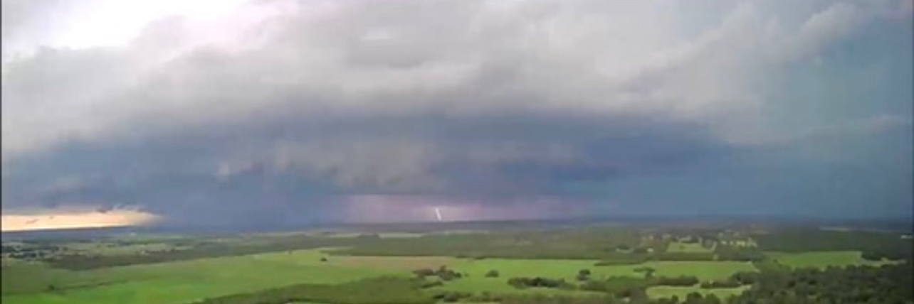
An outbreak of intense and titanic thunderstorm cells is underway across a heat-besieged Western Europe, with more than ~15 lightning strikes occurring every second in the strongest storm cores and convective cloud tops chilling down to -68 C (-90 F). The cities of Paris, France and Amsterdam, Netherlands just simultaneously experienced several hours of frenetic lightning activity and heavy rainfall. Now, the original cell that formed over Paris has passed through Belgium and is fast approaching Amsterdam with yet another wall of fierce, electrical convection.
Backpirch Weather190,522 görüntüleme • 21 gün önce

JUST IN: Pacific Typhoon Bavi has explosively intensified into a 160 MPH (260 kph) CATEGORY 5 Super Typhoon, with her core pressure dive-bombing by 61 mbar over the last 24 hours as she becomes consumed in a spherical tsunami of -110 F (-80 C) convection. At this time, she is heading straight for Guam and the Mariana Islands.
Backpirch Weather90,098 görüntüleme • 15 gün önce

Just to the east of Invest 90L’s center, an icy mass of sunset convection is boiling up over the remote deserts of northern Mexico and overflowing across the Rio Grande, pouring torrential thunderstorms into South Texas. Not terribly often you see an NHC-marked AOI so solidly hovering over land like this.
Backpirch Weather186,520 görüntüleme • 1 ay önce

The Sakishima Islands of Japan and northern Taiwan are the next targets for an intensifying Super Typhoon Bavi. While she is expected to weaken down from her current 155 MPH (250 kph), Bavi is a monstrous storm that will be hesitant to lose energy too rapidly. Wherever her large and powerful eyewall ultimately makes landfall could be under a major risk for life-threatening storm surge and destructive winds on Friday. If you are in Taiwan or Ishigaki, begin preparations now for a potential direct strike from this massive Typhoon, and continue monitoring all updates on Bavi’s progress.
Backpirch Weather62,370 görüntüleme • 11 gün önce


Bavi has now sustained Super Typhoon intensity for 70 consecutive hours and counting. Maliciously pulling away from last night’s destructive landfall in Rota, her eye continues to churn as a perfect rotunda of clear, sinking air. Insane longevity at such an upper-echelon strength.
Backpirch Weather68,156 görüntüleme • 13 gün önce

What started out as a single, explosive supercell over Qatar has suddenly congealed into a furious WALL of thunderstorms over the Persian Gulf, just as many models predicted. This seething mass of hail, heavy rain, and high winds is now on a direct collision course with the UAE and Oman, where the most severe storm conditions from the Middle East system may soon be felt. The desert megacities of Abu Dhabi and Dubai are about to, briefly, become drenched urban stormscapes under the cover of a lightning-filled darkness.
Backpirch Weather448,276 görüntüleme • 3 ay önce

Super Typhoon Bavi may already be completing her eyewall replacement cycle. What was just a few hours ago a ragged, imperfect CDO is suddenly circularizing into a symmetrical ring of pure convective ice, forcing renewed subsidence down through the eye. Core temperatures have risen to -15.76 C and are now warming dramatically. This is about to get crazy.
Backpirch Weather55,621 görüntüleme • 15 gün önce

Well, this is crazy. Coming off of her historically violent, 185 MPH landfall in Jamaica, Hurricane Melissa has rapidly reorganized on her way to Cuba despite being heavily disrupted by mountainous terrain. The latest NHC advisory has her back at CATEGORY 4 status with winds of 130 MPH, as a furious explosion of lightning illuminates her western eyewall. What’s more, she is trending well east of her initial forecast cone and may now be threatening Santiago de Cuba, Cuba’s 2nd largest city.
Backpirch Weather867,296 görüntüleme • 8 ay önce

Unbelievable. Melissa just surpassed Hurricane Katrina (2005) as the 7TH MOST INTENSE Atlantic Hurricane in recorded history, with her pressure now down to 901 MBAR. Her torrid eye is reaching unprecedented levels of dryness. -3.94 C at one point. The CDO is shuddering with subzero cloud tops extending more than 50,000 ft into the atmosphere. It is absolutely terrifying to think about the fact that Jamaica is just hours away from getting hit by this HISTORIC monster of a storm.
Backpirch Weather778,991 görüntüleme • 8 ay önce

Melissa has a very real chance of tying Hurricane Allen (1980) as the STRONGEST Atlantic Hurricane on record in post-season analysis. A 252 MPH wind gust in the southern eyewall. The driest eye ever recorded at -2.25 C (Meranti was the previous record at -5.00 C it’s not even close). The highest ADT estimate of all-time. A pressure of at LEAST 892 mbar. Cat 5 strength sustained for 35 consecutive hours. Multiple eyewall mergers. The lowest pressure at landfall in the Western Hemisphere. Yesterday, Hurricane Melissa joined the ranks of some of the most powerful tropical cyclones the world has seen in the satellite era. And tragically, she did so right as she made an unprecedented landfall in Jamaica.
Backpirch Weather731,672 görüntüleme • 8 ay önce